John Lederer’s Zynodoa

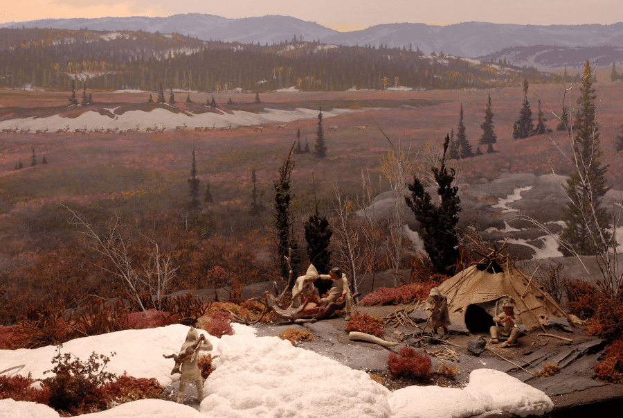
In 1607 the Virginia Company claimed a vast new British colony in the New World; Virginia. Shortly afterwards an official writ declared that Virginia included land between the 34th and 39th parallels, from sea to sea. While the territory was undeniably huge, it was impossible to tell just how huge it was because no one could find a passage to the western sea. European powers were eager to find such a passage, as they believed that India and China lay a short distance from the California coast. However, British colonists had their hands full in the first few decades building forts, raising crops of tobacco, and alternately making war and peace with nearby indigenous groups. Moreover, few possessed the bravery and know-how to traverse the wide Piedmont and ascend the mountain range beyond.

This 1670 map by Augustin Herrman shows English settlement only extended as far westward as the fall line of most major rivers.

As time went on, Governor William Berkeley became increasingly interested in what lay beyond the tidewater. He unsuccessfully petitioned Parliament for 200 armed men to be sent westward in pursuit of California and the Indian Ocean, and in 1669 settled on employing a much smaller band of explorers. At their head was 25 year old John Lederer, a German physician. In contrast to his English counterparts, Lederer kept a careful account of the ventures undertaken in March 1669, and May and August 1670. He wrote in Latin about the geography, fauna, and indigenous populations of central and south-western Virginia, heading from the fall lines of the York and James rivers into the colony of (North) Carolina. His aim was to discover a place the Indians called Sara, where the mountains were low and easy to cross. Lederer’s first travels each lasted for weeks, and included hair-raising incidents like witnessing the murder of two native ambassadors to the Akenatzy (or Occaneechi) king, and bartering his gun and ammunition for his life from the Tuscarora. Still, Lederer wrote that by and large, American Indians lived in peaceful and prosperous settlements, and that many of their elders spoke with intelligence and wisdom likened to contemporary European politicians. But by summer 1670 the political tide had turned against the young German, so his foray from the Rappahannock river to the Appalachians would be his last.

Map of John Lederer’s adventures. His journey to the lower Shenandoah Valley in August 1670 is shown at the far right.

This time the route veered North rather than South. There was rumored to be a gap in the mountains in Northern Virginia known only as Zynodoa. Lederer set out in late August with Colonel John Catlett and a handful of both European and American Indian guides. Catlett was a natural choice, being the sheriff of Rappahannock County (now Essex County) and the owner of 200 acres near the fall line of the Rappahannock River. They set out from Catlett’s neighbor Robert Taliaferro’s property near present-day Fredericksburg and followed the Rappahannock’s northwesterly direction for two days. Those familiar with Northern Virginia’s hills, fields, and streams will recognize Lederer’s description:

“These Savanae are low grounds at the foot of the Apalataeans. . . [and] their verdure is wonderful pleasant to the eye, especially of such as having travelled through the shade of the vast forest, come out of a melancholy darkness of a sudden, into a clear and open skie. To heighten the beauty of these parts, the first springs of most of those great rivers which run into the Atlantick ocean, or Cheseapeack Bay, do here break out, and in various branches interlace the flowry meads, whose luxurious herbage invites numerous herds of red deer. . . to feed.”

John Lederer, 1670
Detail of Lederer’s map to show his journey East to West along the Rappahannock. Robert Taliaferro’s property near present-day Fredericksburg is at the far right.

On the twenty-sixth of August the party came to the foot of the Blue Ridge. Finding no way up for the horses, Lederer, Catlett, and a few other individuals scaled the mountain and named it for the king. This point is believed to be at Linden, Virginia, where a marker declares the 1669 discovery of the Shenandoah Valley by a European explorer. Lederer wrote that the air was thick and cold on the mountain, and it took most of the day to reach the summit. Here, they were hoping to see what had eluded Europeans for so long: a glimpse of an easy pass through the mountains, and maybe even a glimmer of a sea beyond.

Looking across the Blue Ridge, Photo by Mike Chirieleison

They were not so lucky, but doubtless the view they saw was a beautiful one. On reaching the summit of their little mountain, Lederer and Catlett saw . . . more mountains. Many more mountains, much taller than the one they now occupied, arranged in a ridge some 50 leagues away, by Colonel Catlett’s estimation. There was no sign of Zynodoa, a gateway through the mountain range. Deflated, the party returned to the Tidewater. Here we may well have lost Lederer’s account of his travels, as Governor Berkeley was no longer interested in making them public. In fact, Lederer himself had to move to Maryland as he had few friends among Virginia society. It’s here that his record was translated and published in 1772 by Maryland Governor William Talbot, who no doubt still hoped to discover Zynodoa and the riches of the West. Within a century Zynodoa and the valley would be called by their modern name, Shenandoah.

Fauquier County’s Golden Age

 I knew a single instance of gold found in this state. It was interspersed in small specks through a lump of ore, of about four pounds weight, which yielded seventeen penny-weight of gold, of extraordinary ductility. This ore was found on the North side of Rappahanock, about four miles below the falls. I never heard of any other indication of gold in its neighbourhood.

Thomas Jefferson, Notes on the State of Virginia

When we think of gold rushes in American history, the mind usually goes to California and the great gold rush of 1849. Beyond that, there is the gold rush in the hills of northwest Georgia that resulted in the displacement of the Cherokee, or the Yukon gold rush that turned Seattle into a major port of departure for Alaska and northwest Canada. Although it never reached the scale of these larger strikes, Virginia had a small but profitable gold industry through much of the 19th century, and the southern portion of the Heritage Area was at the epicenter of this industry.

There is a narrow band of gold-bearing rock that runs along the Appalachian foothills from Maryland south, running right through the southern tip of Fauquier County and central Virginia. Small amounts of gold had been noticed there in the colonial era, but it wasn’t until the early 1800s that intensive mining was established in the area. The Whitehall Mine, established in 1804 in Spotsylvania County, was the first commercial gold mine in the state. Within two decades, however, the number of mines began to explode throughout Virginia. These early mines were strip or lode mines, where the top soil was stripped off in wide swaths to get to exposed seams of gold ore. This method, although destructive, was the easiest method to get at gold deposits close to the surface. Later, as these deposits wore out, some mines adapted to shaft mining, where shafts were sunk deep into the earth to get to less accessible deposits – a much more costly and dangerous system.

An abandoned gold mine shaft in Virginia.

The earliest gold mine in Fauquier County was the Union Gold Mine, chartered in 1818. Located near Sumerduck, the company hired experienced English miners from Cornwall to dig a 5,000 foot shaft. The Union Mine remained in operation until the gold was exhausted in 1869. The nearby Franklin Gold Mine was opened in the 1820s, and was likely the most profitable in Fauquier County. Between 1825 and 1861, this mine supposedly produced $1,200,000 worth of gold. All together, Virginia gold mines sent over 74,000 ounces of gold to the US mint in Philadelphia between 1829 and 1860. During this same period there were around twenty different mines operating in Fauquier County alone.

1876 Map of Fauquier County, showing several gold mines near Morrisville (Library of Congress)

The gold mining industry in Fauquier County was dealt a significant blow by the coming of the Civil War. Some mines tried to remain in production, as the Confederate government desperately needed gold to support the war effort. The lack of manpower became acute, however, as men joined the army and enslaved workers escaped. Many of the mines became targets for the US Army, and much mine equipment was destroyed.

Some mining operations resumed after the war, and by the end of the century, fourteen mines were opened in Fauquier County. The Franklin Mine reopened in 1868 and operated on and off until the 1930s. Most Fauquier gold mines did not last as long. By the turn of the century, most of the easily mined veins had been exploited, and the cost of labor and equipment made shaft mining too costly. Fluctuations in the price of gold occasionally prompted some mines to reopen, but the industry never again approached its pre-Civil War prominence. The Virginia gold industry finally came to an end during World War II, as gold mines were again shut down so that workers could join the war effort.

“Hornet Balls” were filled with ore and rolled to crush the rock and release gold

Although commercial gold mining in Fauquier County has been dormant for decades, individuals can still visit the area and pan for gold in the local streams. Another important reminder of Virginia’s gold mining past is located in Goldvein, Virginia. The Gold Mining Camp Museum at Monroe Park features several structures depicting a 1930s mining camp, and the museum staff also conducts gold panning demonstrations.

1930s Mining Camp buildings at Monroe Park (Fauquier Parks)

In your own words, please answer the following questions:

  1. Describe the two mining techniques used in Fauquier County. What are the advantages and disadvantages of each?
  2. What factors led to the end of commercial gold mining in Virginia?

A Revolutionary War-Era Estate Meets the Cold War

Two vastly different eras, both facing geopolitical tensions; both witnessed from the rolling hills of Millwood in southern Clarke County.

I recently joined colleagues from the Clarke County Historical Association at Millwood to do some history-based videos. We are all pitching in to get local history education to folks hungry for learning, or for teaching their homebound students, or at least in need of distraction.  Our focus in Millwood was Carter Hall, built by Nathaniel Burwell between 1792-1800, but the owners, Project Hope, also mentioned a Cold War Bunker on the property.

Carter Hall in Millwood, with 1814 portico

Nathaniel Burwell, Tidewater gentry and a Virginia Delegate during the Constitution-ratifying days, moved from Carter’s Grove on the James River, up to Frederick County (later separated into Clarke County in 1836) on the tide of primogeniture refugees. He was looking for opportunity or land not depleted by tobacco or coastal sicknesses.  He was also a great-grandson of “King” Carter and therefore an aristocrat.

Nathaniel Burwell was community-minded, co-owning the Burwell-Morgan Mill with Revolutionary War hero, Daniel Morgan, in Millwood. He also donated the land to the Episcopal Church to build Old Chapel in 1793, which is on the National Register of Historic Places. Old Chapel included a cemetery, in which longtime Carter Hall extended stay guest, Edmund Randolph was buried in 1813, as well as Nathaniel Burwell himself one year later. In 1814, George Burwell, inheritor of Carter Hall, commissioned Dr. William Thornton, architect of the new Capitol building, to design the portico we recognize today.

1793 Old Chapel

Moving quickly, we jump to 1930 when Gerard Lambert and family took possession of Carter Hall as a sort of legacy birthright as Mr. Lambert believed he descended from “King” Carter. Gerard Lambert marketed his father’s invention of Listerine as an opportunity for the masses to overcome halitosis, and provided his family with immense wealth that enabled them to live at Carter Hall and also to provide funding for Charles Lindbergh’s transatlantic flight.  

The Lamberts at Carter Hall brought a massive restoration, using European architectural features and trends, and introduced terraced, formally-elegant gardens and landscape design. Rachel Lambert, daughter of Gerard and a student at nearby Foxcroft School, picked up a horticultural education that would make her world-famous in the 1960s. 

Rachel Lambert grew up to become Bunny Mellon, the legendary horticulturalist and philanthropist who always carried a torch for Carter Hall and Millwood. She moved to nearby Upperville and there she designed and funded the 1960 construction of Trinity Episcopal Church, modeled after a 12th-century French church campus. Next, she helped her dear friend, First Lady Jacqueline Kennedy, by designing the White House’s Rose Garden. Mrs. Kennedy, later as Mrs. Onassis, and Bunny Mellon visited Millwood often to antique.

Trinity Church, Upperville

Enter the second part of my day at Carter Hall, those elusive Cold War stories of bunkers and nuclear fallout. The Mellon family allegedly constructed five underground bunkers during the Cold War in the area, to provide housing for staff and family in the event of nuclear war against nearby Washington DC.

The Mosby Heritage Area has its share of Cold War facilities, actually. Just a half hour away from Carter Hall was Vint Hill in Fauquier County, which was opened in World War II as an Army Base and National Security Agency facility. Vint Hill’s role in the Cold War came out in the late 1980s near the end of hostilities, when articles disclosed that Vint Hill’s Signals Intelligence intercepted Soviet diplomatic and military communiques. Vint Hill even had a cryptology school!

Quite close to Carter Hall, of course, is Mt. Weather, known as Camp 114 from 1943-1946. Mt. Weather was, yes, a weather bureau, born of the late 1800s, but re-purposed during World War II as a Civilian Public Service Facility (Camp 114) where conscientious objectors could still serve their country during wartime by coding maps, tracking Pacific weather, and learning Russian. Camp 114 housed about 60 men until an Iron Curtain was hung, and the facility became a relocation site in the event of nuclear bombing in the capital.  In 1959, Area B, the underground bunker, was completed with the task of housing key Civilian and Military leaders, and priceless works of art from the National Gallery, in the event of Communist attack. When TWA Flight 514 crashed at Mt. Weather in 1974, curious locals and news crews tried to catch a glimpse of that underground bunker, to little avail. Area B was also used by Congressional leaders during the 9/11 attacks.

The crash site of flight 514

As many Americans can tell you, not least because of duck-and-cover drills, the Cold War was a strange time.  No wonder the Mellon family built underground bunkers.  We had the opportunity to throw open the trapdoor, climb down into the bunker (which is at an undisclosed location of course), and see the mod furniture left in place, the shower and the ventilation unit rusting away. Stay tuned for a video of our underground explorations later this week!

A ventilation shaft is one of few clues that a Cold War bunker lies beneath

Many of my peers who saw the end of the Cold War in 1991 would predict this blog post would show a shaky juxtaposition between the Revolutionary War figures who overthrew a monarch’s rule with the Soviet containment we grew up overhearing. And yet, what brought me into the lifelong study of history so many years ago, is exactly this. The rippled glass windows overlooking a pastoral landscape from a Colonial estate are the same windows a Generation X’er looked through wondering if a nuclear mushroom cloud could be seen from Washington DC.  History evolves, us with it, and it is thanks to preservationists that make it possible to view this landscape today from the same windows as founding fathers or Cold War protesters.

Richard Norris Brooke: A Reconstructed Artist?

The Mosby Heritage Area is full of historical figures and their stories, from Daniel Morgan to Jacqueline Kennedy Onassis. Most of the Heritage Area’s most famous individuals were political or military superstars, but our five counties are also home to some nation-building artists. This is a brief look at one such artist and how his perspective changed during Reconstruction.

In October 1847 Richard Norris Brooke was born in Warrenton, Virginia. He came of age during the Civil War, though as a teenager he never took up arms. His father, James Vass Brooke, was a prominent lawyer, mayor of Warrenton, and signer of the 1861 Order of Secession. James Vass Brooke also raised “Brooke’s Battery”, which served throughout the war and at Gettysburg. Richard’s barely older brother (they were born nine months apart) served in Company D, 43rd VA, commonly called Mosby’s Rangers. William Throckmorton “Willie” Brooke so impressed John Mosby that he appointed the younger man as his vice consul in Hong Kong following the war. Local historian John Toler believes that as a boy, Richard Norris Brooke painted crosses for soldiers killed during First Manassas, hundreds of whom came to Warrenton to be treated and later buried. If this was his first experience with painting, it was quite an education. At the Civil War’s conclusion, Richard studied art at the Pennsylvania Academy of Fine Arts, and taught art in Philadelphia and then at VMI.

“Furling the Flag”, Richard Norris Brooke, 1871.

In the years following, Virginia reeled from the Civil War. Towns had been shattered, families sundered, and traditional culture turned on its head. For many white residents, Reconstruction and the 13th and 15th amendments were uncomfortable bedfellows. Former Confederates were not used to seeing African Americans working for wages, going to schools, and even voting. In art and popular media they were portrayed in unflattering caricature. The perceived otherliness of black people is evident in some of Brooke’s earliest work published in Harper’s Weekly. Brooke depicts these Americans as pernicious, shabby, cruel, and comical. Modern viewers cannot know Brooke’s personal thoughts about race at this time, or if he made artwork to match what he saw other illustrators doing.

As Brooke’s career developed, so did his artistic eye and ability. From 1873-1877 he served as a consul in La Rochelle, France, and began studying French Realism (also called Naturalism.) His instructor, revered artist Leon Bonnat, prized simplicity and truth in painting. No artifice, no flash, just authenticity and humility. Brooke studied peasants, farmers, cottages, and scrubby landscapes in Italy and France. Whereas previous artistic movements encouraged artists to make moral statements about poverty, dirtiness, and decay, Realism and Naturalism uncovered the dignity of simple life. Bonnat and other artists strove to observe and reflect what they saw, rather than commentate. Brooke’s art journal includes dozens of studies and sketches from this period. While he does not outwardly discuss the parallels between European peasants and Virginians of color, his artwork later makes the comparison clear.

“Old Brittany Woman” Richard Norris Brooke. From his personal journal, which listed over 800 paintings, charcoal drawings, and sketches, along with a small thumbnail of each piece.

When illness brought Richard Norris Brooke back to Warrenton, he set up a portrait studio in town near his father’s house and began taking commissions. Many artists of this time made their living by painting portraits for the affluent and upper middle members of society, and Brooke was no exception. But it is also around this time he struck out to paint an honest genre scene of black Virginians. According to his journal, Brooke contemplated the piece for a long while before undertaking it. It was a posed genre scene, specifically set to represent an occasion that would be universally understood: a family hosting the pastor for supper. To populate the scene Brooke called on individuals (neighbors? friends? former servants?) he knew. A gentleman named George Washington was the model for the pastor, and a younger man, Daniel Brown, sat for the host. Georgianna Weeks portrayed the wife figure. Brooke’s level of detail suggests familiarity with the children as well. The end result is the 1881 piece, “The Pastoral Visit.”

“The Pastoral Visit” or “A Pastoral Visit”, Richard Norris Brooke, 1881. National Gallery of Art

In this piece the viewer sees a much more nuanced depiction of black individuals and black social life. The bespectacled pastor in somber clothes occupies the best seat in the home. He is served first, and after the meal the pastor will be given a cigar box containing his parishioners’ weekly offering. The banjo suggests that a song or tune will cap off the evening. The scene includes domestic details that might be seen in any modest home. A coffee grinder, ginger jar, and iron occupy the mantel. A kitten drinks milk from a dish. The family’s hands and faces have all been scrubbed for this social occasion, and while furniture and clothing may be worn, everything is clean.

It is striking how different this rendering is from Brooke’s illustrations for Harper’s Weekly less than ten years prior. His perspective had clearly changed, and he had no patience for artists who perpetuated the stereotypical treatment of African Americans. In a letter to the Corcoran’s trustees, Brooke decried “the flimsy treatment and vulgar exaggeration” usually afforded to black subjects. He readily admits to having painted the scene on purpose, “to elevate it to that plane of sober and truthful treatment which. . . should characterize every work of Art.” Though he didn’t want to be typecast as a painter of black subjects, some of his best received works were in that vein, including “The Pastoral Visit”‘s companion piece, “A Dog Swap.” A painting with more nuance, A Dog Swap is much less rigid in both its setting and painting style. While Brooke did not list the models he used for this piece, the figure on the far left looks very similar to George Washington, the man who sat for the Pastor.

Richard Norris Brooke, A Dog Swap, 1881, oil on canvas, Smithsonian American Art Museum, Gift of Colonel Thomas G. Young, Jr., 1956.

Even though the setting is rougher, Brooke still treats his models with dignity. Instead of painting ‘a person of color’, he is clearly painting real individuals. While The Pastoral Visit shows a family in their Sunday best, perhaps A Dog Swap shows what Warrenton’s poorer families might be up to in their own informal spaces. Every figure is relaxed, indeed, every figure is leaning or resting on something or someone else. Nods to rural life- including a cabbage and a homemade birding net- would be familiar to Americans throughout the continent. What did the sitters think about having their likeness seen in the Corcoran Gallery of art? No record is left, but it is interesting to think that these genre scenes are probably the only remaining portraits made of Warrenton’s black residents during Reconstruction.

Both The Pastoral Visit and A Dog Swap helped Brooke achieve notoriety, though of his 800+ paintings most were landscapes and formal portraits. In 1881 he opened a studio on Pennsylvania Avenue, splitting his time between Washington D.C. and Warrenton. He was a leader in many arts organizations including the Washington Art Club and Society of Washington Artists. His most prestigious role was as Vice Principal of the Corcoran School of Art from 1902 to 1917. Sadly, a 1909 fire in Warrenton destroyed his studio there, along with some 225 works of art. Nevertheless, Brooke’s artwork has been shown in the National Gallery of Art, the Chicago World’s Fair, the Army and Navy Clubs, the U.S. Capitol Building, numerous courthouses, and countless private homes.

Richard Norris Brooke

In your own words, please answer the following questions:

  1. In what ways did the Brooke family participate in the Civil War?
  2. Compare the black and white Harper’s Weekly images to the painting The Pastoral Visit. Which one do you think is more truthful, and why?

The First Virginians

15,000 years ago, the northern Virginia Piedmont looked drastically different than it does today. As the ice sheets retreated northward, the climate was cooler and dryer than today. Coniferous trees predominated, intermingled with stands of oaks and chestnuts and small patches of open grassland. The deer that are so common today mingled with species that have long disappeared from Virginia, including bison, elk, and even mastodon. Humans also began to settle in the region, following these big game animals and searching for natural resources. Archaeologists refer to these people as the Paleoindians, and they are the precursors of today’s Native Americans.

A recreation of a Paleoindian camp (The State Museum of Pennsylvania)

The Paleoindian period in Virginia, defined as roughly 16,000 to 8,000 BC, was characterized by nomadic family groups of 20 to 50 people. These groups moved seasonally to follow big game, and to collect nuts, fruits, and other foods. One of the most critical natural resources for the Paleoindian people was access to the appropriate stone to make tools. Axes, drills, knives, and spearpoints were knapped from stones that chipped easily and left sharp edges, like flint, jasper, and quartz. The definitive artifact of this period – the Clovis style spear point – is a great example of this technology. Although they are named after the town in New Mexico where they were first discovered, Clovis points are found all across North America, including many sites in Virginia.

A Clovis point recovered in nearby Maryland (Maryland Archaeological Conservation Lab)

The Paleoindians of Virginia lived long before writing, so everything we know about them comes from the professional excavation of archaeological sites. One of the most important complexes of Paleo sites ever discovered is located within the Mosby Heritage Area, along the banks of the Shenandoah in Warren County. The Thunderbird and Flint Run Archaeological Districts encompass a series of sites that date to the Paleoindian period, around 9000 BC. The discovery of these sites in the 1970s revolutionized much of what we knew about ancient Virginians.

One of the most remarkable things about the sites in Warren County is the sheer number of artifacts recovered by archaeologists. Tens of thousands of Paleoindian tools and other artifacts made of stone and bone were found, which suggests that the sites were occupied on and off for thousands of years. These included tools for making stone blades, and tools for processing animals for food. It also suggests that people lived there in much larger groups than previously thought. It’s possible that several hundred, or even a few thousand people occupied these sites on a seasonal basis. This idea was reinforced by the discovery of several post-molds arranged in an oval shape in the soil. These impressions, left behind when posts rot away or are removed, appear to be the remains of a Paleoindian building. These stains in the soil are evidence of the oldest building in all of North America. So what brought so many people to Warren County back in 9000 BC? The answer is probably found in the rocks themselves. The area has deposits of jasper, a perfect material for producing stone tools, and separate areas of the Thunderbird site were used for quarrying material, making tools, and processing game.

Archaeologists reconstructing the frame of the Paleoindian structure based on the evidence they discovered.

A huge part of our mission at the Mosby Heritage Area Association is the preservation of historic resources. We tend to think of historic buildings, battlefields, and communities that we can see on the everyday landscape as our most important resources, but this also includes the sites beneath our feet. To help ensure that we can learn as much as we can from archaeological sites, the best thing to do is leave excavation to the professionals. Digging for artifacts without recording their proper context destroys valuable information about the past!

For more information on Paleoindians in Virginia, visit the Encyclopedia Virginia!

Class Activity: In your own words, please answer the following questions:

  1. How was the environment different in Virginia when the Paleoindians lived here?
  2. What drew Paleoindians to settle at the Thunderbird sites?
  3. List two clues that archaeologists discovered that helped them understand how Paleoindians lived.

Camelot in the Country

There is a long history of presidential visits to the Virginia Piedmont Heritage Area. Washington surveyed parts of Clarke County in his youth. James Monroe built his country estate at Oak Hill, near Leesburg, in the 1820s. In 1909, Teddy Roosevelt made a highly publicized ride to Warrenton and back in the middle of winter. Nearly every president passed through the area on their way to or from Washington, but few presidential visitors left a local legacy as enduring as John F. Kennedy.

The Kennedys first came to the Heritage Area in February 1961, shortly after John’s inauguration. An avid equestrienne, Mrs. Kennedy was drawn to the culture and landscape of Virginia’s hunt country. She arranged to rent the historic estate of Glen Ora, just outside of Middleburg. Unlike his wife, the President was not as enamored with hunt country. One Kennedy family biographer noted that he “preferred the ocean, not the countryside.” Despite his preferences, the family soon became fixtures around town.

Middleburg, like most communities in Virginia in the 1960s, was a strictly segregated town. African-Americans were not allowed to dine in at the local restaurants or pharmacy lunch counters. There were two separate Community Centers. When news broke that the newly elected president and his family were coming to visit in February, 1961, local African-American leaders saw an opportunity to strike a blow on segregation.

While local groups had fought for better schools and conditions for African-Americans for generations, the campaign to end segregation in Middleburg began with two students from Howard University. They sat down at the counter of Flournoy’s Drug Store, where they were refused service. That spring, a larger sit-in was planned for the same weekend that President Kennedy would be in town. It was specifically calendared on a Sunday, so the Kennedys -and the press that followed them- couldn’t ignore the protesters as the Kennedys attended mass at the Community Center. Wanting to integrate without scandal or violence, Middleburg resident and Loudoun NAACP leader William McKinley Jackson joined with Albert Pereira, a like-minded local Catholic priest. Together, Jackson and Pereira met with local leaders to insist that public businesses desegregate before the staged sit-in. Their case was simple: Middleburg had an opportunity to stand up for progress and equality, or to be known nationally as a backwards town. There was also the added pressure not to embarrass the visiting President.

(Below, William McKinley Jackson in the 1960’s, Albert Pereira at his ordination in 1940)

Jackson and Pereira’s argument was a convincing one, and the leaders agreed to end the segregation of public spaces. During his April 10th mass, Father Pereira led the congregation in prayer, “Let us pray together today that understanding and love may exist between the races, and that from now on, the area of communications be broadened so that Negroes will have the opportunity to become first-class citizens.” Buoyed by their success, Jackson and the Loudoun NAACP set their sights on Leesburg, and led desegregation efforts throughout the county. Fr. Pereira became a close friend and advisor to the President and his brother, Robert F. Kennedy.

While Kennedy never made public remarks about desegregation in Middleburg, America’s most famous family made long-term plans to be part of the integrated village. In fact, in 1962 Jacqueline met with the architect Keith Williams to build a Middleburg home, Wexford, that the Kennedys could call their own. Sadly, the family did not have much time to enjoy their new retreat. They only spent a handful of weekends together at their new getaway before President Kennedy’s assassination, and in 1964 the barely used home was sold. Although Jackie would continue to be a frequent visitor to Middleburg, it seems she could not bear to stay in the home she had built with her late husband.

President Kennedy and his daughter Caroline leaving services at St. Stephen the Martyr Catholic Church. The church was constructed near Middleburg in 1963 and has a plaque marking the family pew.

The Kennedys left marks across the Middleburg landscape, from Glen Ora to Wexford and St. Stephen’s. Part of that legacy is forever tied up with the civil rights story of Virginia and the timely action of William McKinley Jackson and Fr. Pereira. Middleburg can rightly be proud of how history was changed when Camelot came to the village.

Class Activity: In your own words, please answer the following questions:

  1. What changed in Middleburg between 1960 and 1962? (There are multiple correct answers)
  2. How did lunch counter segregation affect black residents in Loudoun County?
  3. List two individuals who helped end segregation in Middleburg. Why did these individuals do what they did?

“It is Christmas!” A Letter from Leesburg, 1861

Union soldiers opening Christmas boxes in camp during the US civil war, circa 1861. 
American Stock Archive/Archive Photos/Getty Images

Following the stunning Confederate victory at the Battle of Balls Bluff on October 21, 1861, Leesburg welcomed a host of Southern soldiers. Young men from near and far wintered near the Northern Virginia town, and it was the first Christmas away from home for many. Families across the Heritage Area were already separated by the Civil War, and darker days lay ahead. The holidays blanketed the area with cheer, even though the weather was warm and clear. Thomas E. Caffey, an Englishman, signed up with Co. D, the “Hamer Rifles”, 18th Miss., and had this to say about the regiment’s Christmas celebrated in their winter quarters at Morven Park:

While I now write, preparations are going on for ‘winter quarters,’ and the sounds of axes and falling timber are resounding through the woods on every hand. Game cocks tied to the tent by one leg, are crowing defiantly in all directions – chicken-fights are progressing in every sunny spot, while violins and circles of dancers are scattered in every warm and dry location, while others roar out bachanalian and war-like strains from every tent. It is Christmas! Far away from friends and home, these brave and simple-hearted volunteers make the welkin ring with their boisterous mirth – huge logs are crackling and roaring on camp fires – pots are boiling and bubbling, and hissing for egg-nog, beef and pork are frying, and bread is baking – the regimental band has been imbibing, and is now playing away with great gusto, while some have formed setts for quadrilles to be danced by the fire light.

It is Christmas! Groups are reading the newspapers and deciding the fate and progress of the war, officers and men are hobnobbing over the social glass; negroes are busy and gaseous over a pyramid of pots and pans, while the ear-splitting laughter and incessant rolling of eyes gives positive assurance that they have made acquaintance with something stronger than water. Boxes, bales, and trunks, and parcels have come from ‘home’ – coats, and blankets, and boots, and hats are hawked about, and swapped, and sold, and tossed about, while long letters from the ‘Governor,’ and short ones from ‘sweethearts’ are read, and praised, and laughed at, while ‘payday’ coming on the morrow, cheers are given for the quartermaster, and stentorian groans for the inartistic or tardy cash.

It is Christmas! Friends with mysterious bundles and parcels, hid under the coat, arrive from town, and dive therewith into the depth and recesses of the tent, and hide them under the straw – friends with turkeys and fowl, and a hundred other things, meet together and do hungry justice to the same, while songs and stories go the rounds of tents and camps, and everybody laughs, and everybody is ‘jolly’ except the poor and unfortunate frost-covered sentinel, who, with muffled form and a very red nose, walks his lonely rounds and grins at what he cannot then enjoy.

It is Christmas time, and even the lean, lank, solemn looking parson unbends in dignity for the occasion, and while forming one of a circle round the blazing logs, cup in hand, essays to joke, but being ‘coughed down’ for the attempt, winks ominously at the egg-nog, and apostrophises largely on the vanity of things generally. The colonel too, and the lieutenant, and the shrill-toned, brisk and soldierly adjutant smoke their Havanas on the portico of ‘headquarters’ with solemn dignity, while the French band-master electrifies a knot of youngsters with all sorts of ‘impossibilities’ on the trombone.

It is Christmas time, and coming but once a year none care for expenses. Yankees are the last persons thought of – cock-fighting and egg-nog, and egg-nog and cock-fighting interspersed with songs and egg-nog and story-telling are the prime order of things just now, and despite all the parson says, and nothwithstanding the ‘starchiness’ of full-blown officials, rye and ‘egg fruit’ are decidedly in the ascendant, and more than that has no baneful effect, since it simply lends to revive old associations and strengthen those bonds of brotherhood which has indissolubly linked us for ever to the fortunes of our country.

-From a letter published by The Memphis Daily Appeal, January 7, 1862

Class Activity: In your own words, answer the following questions:

  1. How do Virginians and Southerners feel about the war at this time?
  2. What are some popular foods and drinks discussed by the writer?
  3. Examine the image above, “Christmas Boxes in Camp- Christmas 1861.” Describe at least three items that families and friends are sending to their loved ones in camp.

A Historic Crossroads

On November 17th, 1962, President Kennedy and former President Eisenhower came to the Virginia Piedmont to dedicate a new airport. Named for the former Secretary of State John Foster Dulles, this international airport heralded a seismic change in the Northern Virginia landscape. It drew new business investment and burgeoning suburban development into eastern Loudoun County, starting a trend that continues to this day. Beneath the tarmac and terminals, there is the story of one of the Heritage Area‘s lost villages.

The terminal at Dulles Airport in 1962.

Long before the construction of Dulles Airport, the location was home to the village of Willard, which lay at the intersection of Willard and Horsepen Roads. Most of the village inhabitants were African-Americans – descendants of former slaves – who worked on the surrounding farms and orchards that stretched in every direction. The community had coalesced in the decades after the Civil War, centered around a general store/post office and a handful of homes and anchored by a one-room school and the Shiloh Primitive Baptist Church. By the 1890s, Willard was one of several “Freedmen” villages that existed in eastern and southern Loudoun County.

The village took its name from Joseph Edward Willard, a prominent landowner and politician who owned vast tracts of land in the area. His fortune came from the hotel industry, where Joseph’s father and uncle owned and operated the famous Washington hotel that bears the family name. Joseph Willard turned to politics, and was active as a state representative and Lieutenant Governor of Virginia from 1902-1906.

Joseph E. Willard, namesake of the village
The Willard Hotel in Washington

Joseph Willard’s time in Richmond coincided with the heyday of the village of Willard, and by 1910 the village was in decline. The post office shuttered in 1907, and the general store went under during the Great Depression. Willard was home to an early airfield, the Blue Ridge Airport, but that enterprise only lasted from 1938 to 1942. In 1948 the Willard School was closed and moved. By the 1950s, only a few dozen residents remained.

As Willard declined, the suburbs around Washington grew at a record pace, fueled by the post-war economic boom and massive migration to the capital region. Planners struggled to keep pace with development, and building a new international airport to handle increased traffic became a priority. Sites around the Virginia and Maryland suburbs were studied, but many residents objected to the creation of an airport so close to their homes. A decision was finally made in 1958, when Willard was selected to be home to the new airport. The 87 remaining landowners of the village and surrounding countryside were bought out by the Federal government, who acquired nearly 10,000 acres for the project. Over 300 structures were razed to make room for the runways and terminal.

The terminal and control tower under construction.

By the time the airport was dedicated on November 17th, 1962, nearly every trace of Willard had been obliterated from the map. Only a handful of buildings survived to be re-purposed into storage structures along the northern end of the airport. The crossroads at the heart of the village was located just south of Terminals C and D. Millions of visitors travel through Dulles International Airport every year, making it the most significant “crossroads” in the Heritage Area today. How many realize they’re also travelling through the long forgotten crossroads of Willard?

The area surrounding Willard in 1957. The village crossroads is circled.
The same location in 2010.

Class Activity: In your own words, answer the following questions

  1. Who were the first residents of Willard?
  2. How many buildings were destroyed to create Dulles Airport?
  3. Examine the two images above, showing the birds-eye view of Willard before and after the airport was built. Would you have decided to build an airport here? Why or why not?

A Revolutionary Proclamation

            By November 1775, John Murray, the 4th Earl of Dunmore, was struggling to maintain royal authority over the colony of Virginia. He had already been driven out of Williamsburg and had fled to the loyalist stronghold of Norfolk. Now he was beset by growing numbers of disaffected Virginians, and he was in danger of losing the colony altogether if the situation did not drastically change soon. On November 7th, he did the unthinkable.

John Murray, 4th Earl of Dunmore and last Royal Governor of Virginia

            From the safety of the ship William off of Norfolk, Lord Dunmore penned a proclamation that would shake Virginia to its core and dramatically alter the course of the American Revolution. The proclamation declared martial law over the colony, and asked all able-bodied men to rally to the Royal standard. Then it took a revolutionary turn. The Royal Governor “declare[d] all indented servants, Negroes, or others (appertaining to rebels) free, that are able and willing to bear arms, they joining his Majesty’s troops.” Dunmore was now offering the first large scale emancipation in American history.

Dunmore’s Proclamation (Colonial Williamsburg Foundation)

            Like the Emancipation Proclamation that followed nearly a century later, Dunmore’s Proclamation was a military and political measure. By depriving colonial leaders of their economic backbone and raising the specter of slave rebellion, Dunmore hoped that Virginians would be reduced “to a proper sense of their duty.” Most colonial leaders, however, had the opposite reaction. Patriot leaders used the document as proof of British barbarity, and many Virginians were so appalled that they abandoned neutrality for the rebel cause. The Virginia Convention declared that any enslaved person running away to join Dunmore would have 10 days to return and be pardoned, or else they would be summarily executed. Thomas Jefferson went as far as to reference the proclamation as one of the American grievances in the Declaration of Independence, writing that the King “has excited domestic insurrections amongst us.”

            For African-Americans throughout the Chesapeake region, though, the Proclamation was a beacon of hope, and as many as two thousand enslaved men, women, and children risked death to escape to the British in 1775-1776. Many of the newly-freed men were armed and organized into a regiment entitled “The Royal Ethiopian Regiment,” while others found employment as teamsters, sailors, and laborers. In early 1776, command of the Ethiopian Regiment would eventually fall to Captain Thomas Taylor Byrd, a native-born Virginian and commissioned officer in the British 16th Regiment of Foot. Ironically, Byrd was the son of William Byrd III of Westover, who owned vast tracts of land and hundreds of enslaved people.

              Over the winter and early spring of 1776, Dunmore and his forces were gradually driven from Norfolk and forced to take refuge on a “floating city” of ships, barges, canoes, and other vessels. As the fleet was chased across the Chesapeake, Dunmore’s force was eroded by smallpox and typhus. The diseases hit the formerly enslaved particularly hard, and hundreds died. The governor and his small army were at last driven from Virginia in July, when they were forced to abandon their base on Gwynns Island. One of the last to be evacuated was Thomas Byrd, who was so ill that he had to be dragged away on a cart.

A list of soldiers in the Ethiopian Regiment and other refugees found on Gwynns Island (Colonial Williamsburg Foundation)

            Dunmore’s Proclamation proved to be a disaster for the governor in the short
term. It polarized the colony and hardened Patriot opposition. Although many
African-Americans answered his call, he was unable to effectively build an army
in the face of constant disease. Despite Dunmore’s setbacks, the Proclamation
did have a tremendous impact on the remainder of the war. It effectively made
emancipation an official part of British military policy, and other officers
issued similar proclamations. Over the course of the war tens of
thousands of enslaved people sought freedom through the British. Thousands fled
from Virginia, including an unknown number from the Heritage Area. In May 1778,
a man named Ishmael ran away from William Hepburn’s mill on Bull Run in Prince
William County, and it was supposed he headed towards Norfolk, “as he wants
much to get on board some of the English ships of war.”[i]
Similarly, in August 1780, four young men belonging to William Allison of
Fauquier County named Phill, Adam, Mark, and Will, escaped bondage. Their
former owner feared they escaped “with a design of getting on board some vessel
in the rivers or bay” belonging to the British.[ii]

            Many of those who escaped eventually found refuge
elsewhere in the British Empire. Thousands of formerly enslaved people settled
in Canada alongside displaced white loyalists, while others settled in the
Caribbean or in Sierra Leone. Thomas Taylor Byrd, scion of one of the
wealthiest families in Virginia, found temporary refuge in England. After threeyears he returned to his native state and settled on property owned by his
mother’s family in the Shenandoah Valley. Byrd lived out the rest of his days
near the town of Boyce, and today lays buried in the churchyard of the Old
Chapel, not far from several of his former adversaries who fought for the
patriot cause.

Captain Thomas Taylor Byrd’s grave at the Old Chapel

 Class activity: In your own words, please answer the following questions:

  1. What made Lord Dunmore’s proclamation unusual?
  2. How did people respond to the proclamation?
  3. Was Dunmore’s proclamation successful in emancipating enslaved people in Virginia? Why or why not?

[i] Virginia Gazette (Purdie), Williamsburg, June 12, 1778.

[ii] Virginia Gazette (Dixon
& Nicolson), Richmond, August 9, 1780.

“There was a want of vigilance”: Intelligence in the Bristoe Station Campaign

The Mosby Heritage Area is a wide landscape of historic rivers and turnpikes crisscrossed by rail lines. Our location in between the Potomac River and Richmond was crucial to United States and Confederate forces during the Civil War, even though relatively few large-scale battles were fought here. The Heritage Area did see a number of fast-moving campaigns as armies attempted to out-flank, out-smart, and out-maneuver each other along essential travel and supply lines. The Bristoe Campaign in October 1863 falls under this category. Much of this campaign was colored by scant information, leading to close shaves on both sides before A.P. Hill’s decisive action on October 14th.

Fall 1863 found Generals Meade and Lee apparently deadlocked in central Virginia on opposite sides of the Rapidan River between Orange Courthouse and Culpeper Courthouse. Both Union and Confederate commanders learned hard lessons on the road from Gettysburg, and both recently sent supporting corps to the western theater. By October, Meade and the Federal Army seemed prepared to make winter quarters. The United States position at the fork of the Rapidan and Rappahannock controlled not only the Rappahannock crossing, but also the crucial supply line of the Alexandria & Orange railroad.

Culpeper Courthouse (center building with cupola) during the Civil War

Plans for a peaceful fall were thwarted when the Federal signalmen on Pony Mountain intercepted a message on October 7. Lee was on the move. Not knowing the Confederate codes had been broken, Lee urged his commanders to be careful and quiet as they skirted the Federal line, attempting to cut off Meade’s rear route along the A&O. But since receiving the decoded message, Federal scouts were primed to notice graycoats moving on the right flank, and campfires missing from the Confederate main body by night. With the signal towers going silent as armies began to move, they would have to rely on traditional intelligence- namely their cavalry- for information during the rest of the campaign.

Meade’s first requirement was to find out where exactly the Confederates were headed. He sent John Buford’s cavalry division to scout the Federal right flank for more signs of Lee, but recalled him after not hearing for two days. Meanwhile, Stuart’s Confederate cavalry harassed Gregg’s and Kilpatrick’s Federal cavalrymen in the vicinity of Brandy Station, resulting in erroneous reports that the Confederate forces were concentrating in Culpeper. By the time the Federal forces caught wise, Ewell’s and Hill’s divisions were closing on Warrenton, having swung wide to catch Meade’s rear on the A&O. Meade acts swiftly to outmaneuver the rebels, benefiting from a direct route up the A&O towards the fortifications at Centreville. The race was on.

With both armies moving quickly, reconnaissance was done on the fly, leading to fighting at Auburn on October 13th when Stuart tried poking around the Union supply train and found himself surrounded by the Federal Second and Third Corps. He his own men, supplies, and artillery in a ravine during the night, a mere 300 yards from his foes. The following morning Stuart surprised a regiment of breakfasting Yankees with a volley from his artillery. His bluff succeeded in unseating Gouvenor Warren’s Second Corps, which marched quickly along the A&O and by early afternoon had reached Bristoe Station.

Historical markers near the site of Coffee Hill

The afternoon of October 14th found A.P. Hill scouting for an attack. From his position the Confederate Second Corps could just make out the Federal Third and Fifth Corps moving from eastward over Broad Run. If the rebels moved quickly (without reconnaissance), they just might catch them. Instead Hill’s North Carolinians under Cooke and Kirkland were caught by Warren’s Second Corps, which had been recuperating from the morning fighting at Auburn, taking shelter on the southern side of the high railroad embankment. Unseen until the last moment, Federals sprang up and fired, cutting down waves of gray-clad rebels. Over the next couple of hours about 2,000 men fell, effectively putting an end to Lee’s devices on Meade’s supply route.

The Union Second Corps position under Gouvenor Warren fired on Confederates from behind this embankment. Photo by Douglas Ullman, Jr.

While Gouvenor Warren earned some praise for his action at Bristoe Station, the United States press was reluctant to call the battle a Union victory. There was even talk of Meade’s replacement. In the Confederacy, there was little doubt that Bristoe was a blunder and a loss. Hill was lambasted as a fool for making an attack with so little information. Confederate President Jefferson Davis critically pointed out, “There was a want of vigilance”.

Though much of the area surrounding Bristoe Station has been developed, preservation efforts have ensured that large sections of the battlefield are open to learn and explore. For more information about the battle and ongoing preservation, visit our friends at the Bristoe Station Battlefield Park!

Class Activity: In your own words, answer the following questions

  1. What are different ways Civil War officers gained intelligence or communicated with each other? Describe at least two.
  2. Examine the image above, “The Union second corps position.” United States troops sheltered behind this railroad embankment during the battle. What made it such a good position?
  3. Why do you think we should preserve historic landscapes like the battlefield near Bristoe Station?