“For love, money, or marbles”, the Great Hound Match of 1905

It started with a feud in the paper and two Masters of Foxhounds from Massachusetts. Harry Worcester Smith, MFH Grafton Hunt, wrote in Rider and Driver that the American foxhound should be a recognized breed, separate from British bred foxhounds. Meanwhile Alexander Henry Higginson, MFH Middlesex Hunt, insisted that there was no such thing as an “American” breed, and that if there were, British foxhounds were still superior. A challenge was proposed. Smith was to gather hounds, Higginson would do the same and the packs would duke it out “for love, money, or marbles”, according to Higginson. The goal was simple: the pack that best caught foxes would be the winner. These Massachusetts Masters of Foxhounds decided that Middleburg, Virginia, would be the battleground on which the Great Hound Match would take place, and November 1 would be the first day of reckoning.

The Middleburg and Upperville areas were used to being contested territory. During the Civil War, the Virginia Piedmont Heritage Area was a borderland where armies skirmished and partisan rangers prowled. Most residents had at least one family member who had drawn arms in support of the Confederacy barely a generation ago. But newly arrived Northerners found they had a stake in history of the area too. On July 17, 1863 during the Battle of Aldie, Major Henry Lee Higginson, 1st Massachusetts cavalry, was knocked from the saddle, slashed with a saber, and shot twice. The elder Higginson survived the ordeal to become a successful broker, founder of the Boston Symphony Orchestra, and sometime advisor to President Woodrow Wilson. Forty-two years after Higginson’s wounding at Aldie, his son Alexander Henry Higginson returned for a friendly competition in what used to be dangerous rebel territory.

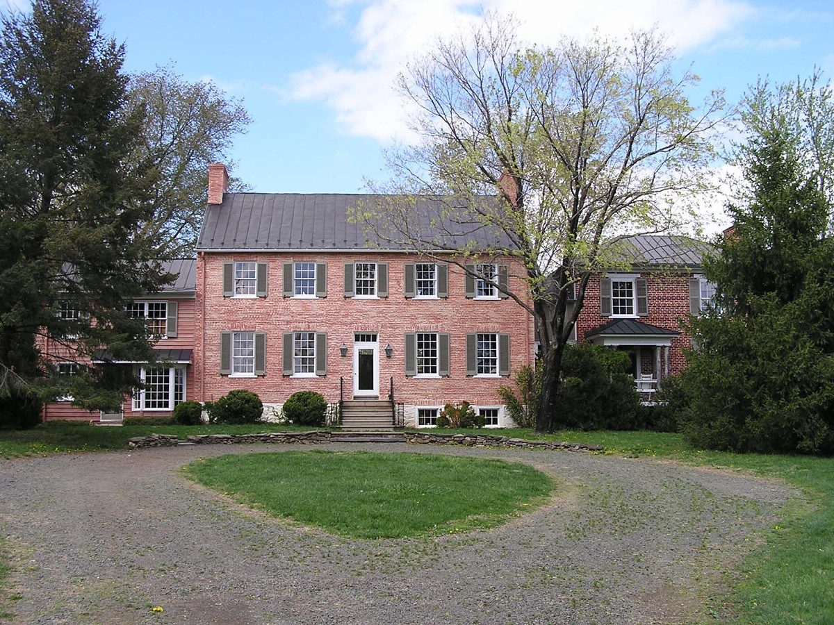
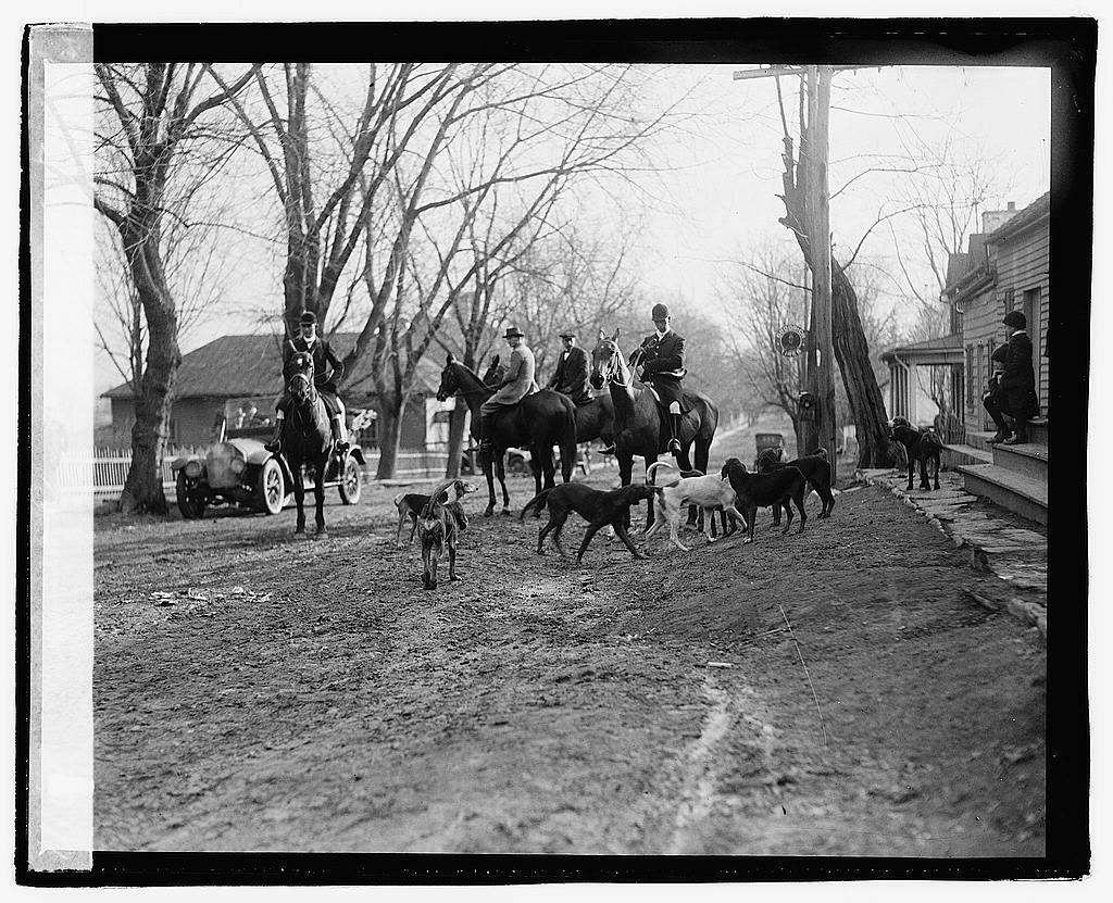
It was no surprise that the Loudoun Valley was chosen as the site for the Great Hound Match. Foxhunting had taken place in the area for nearly 150 years, and it was home to the United States’ oldest hunt club, the Piedmont Fox Hounds, founded in 1840 by Col. Richard Henry Dulany. In fact, the first day’s hunt began at the Colonel’s home, Welbourne, and was dedicated to the 85-year-old hunt progenitor. Dulany’s nephew, Henry Rozier Dulany, Jr., hosted Harry Worcester Smith and the Grafton hounds at Oakley near Upperville. Throughout the Great Hound Match, the field was dotted with equestrians from home and abroad, indeed, participants from 26 hunts joined in on the fun, including one hunt each from Canada, England, and Ireland. Northern Virginia’s rolling hills and rural pastures were (and still are) strikingly similar to traditional hunt country in Leicestershire, England, but the bucolic setting belies surprisingly deep creeks and steep cliffs. It is exactly the right setting for a grand drama on horseback, and that’s just what unfolded in November of 1905 as riders, whippers-in, hounds, reporters, grooms, and over 100 horses descended on the little train station in The Plains.

This undated photo of Welbourne was sent to Harry Worcester Smith, courtesy of NSLM

Far from the glitzy hotels and sparkling nightlife of New York City, Boston, and Washington, D.C., visiting equestrians hacked back and forth to Hound Match meets on dirt roads often mired in mud and farm traffic. Higginson’s British hounds from the Middlesex Hunt proved to be most popular during the Match, often drawing a field of 50 or more. Onlookers praised the foreign-born hounds’ cohesiveness, and while the hounds traveled fast, nearly everyone could keep up. Higginson was wont to meet in Middleburg and cast his hounds north of town towards the Fred Farm or at Lemmon’s Bottom just across the Goose Creek Bridge. In comparison, Harry Worcester Smith’s Grafton hounds often met at Oakley but would then gallop across the territory, from Upperville to Unison to Oatlands and back in one morning. On November 9th they met at Zulla and were headed to The Plains when the Grafton hounds ran head-first into the Orange County Hounds, who were out that morning with MFH John Townsend. The OCH was founded in Goshen NY in 1900 and only started hunting in Virginia in 1903. It was only a matter of time before all the Northerners started bumping into each other! Throughout the Match, the Grafton hounds went fast. A field that might start with 20-30 riders sometimes ended with barely a third of that number, and twice the hounds were separated from Smith and had to be rounded up hours later. Among the stalwart hunters who managed to keep up with the hounds were a handful of young riders, and usually a Mrs. Tom Peirce from Boston who rode aside. Flocks of locals followed the match on horseback, hilltopping at key vantage points to see the hunt field surge past in pursuit of the wily Reynard. While hunting near the Fletcher farm, Smith called out to a rider who was trampling through a farmer’s field of winter wheat. Smith demanded that the “son-of-a-bitch” stop destroying the delicate crop, to which the rider responded it was his wheat and he’d ride over it if he pleased.

Piedmont Foxhounds in Upperville, 1921. Note that even the Ashby’s Gap Turnpike (Rt 50 today) is unpaved

The Piedmont landscape took a toll on even the most experienced riders. Frederick Okie of Piedmont Stock Farm nearly drowned in Pantherskin creek when he and his horse stumbled into a deep pool while chasing after the Middlesex hounds. That same day Harry Worcester Smith managed to break his foot and had to be cut out of his riding boot by Upperville physician Charles Rinker. Julian Ingersoll Chamberlain, who served in the New York cavalry during the Spanish American War, was not the only rider to go head over bridle while jumping over stone and barbed wire fencing. And the risks were not only physical. Higginson and a large number of his followers were arrested by Fauquier resident Amos Payne for trespassing in a wheat field. Payne insisted that all he wanted was a promise that the trespass wouldn’t be repeated, but the magistrate got involved and the situation was only cleared up with the intervention of Richard Henry Dulany, who didn’t want to jeopardize the area’s reputation to visitors.

Active Virginia hunts c. 1938. Photo courtesy of NSLM

The Great Hound Match lasted from November 1-14, with either the Middlesex or Grafton hounds running every single day except Sundays. Despite many chased foxes, no wild foxes were killed during the Match, leading some to speculate that it would result in a draw. However, in the end it was decided that Smith’s American hounds had performed better overall. Higginson accepted defeat with grace, and even his most ardent supporters admitted that they were impressed by the performance of the longer-legged contestants. Though the match was over, both Higginson and Smith had long careers in foxhunting ahead of them. The camaraderie inspired by the Match led to the formation of the Masters of Foxhounds Association of North America in 1907 with – who else?- Harry Worcester Smith as its first President. Alexander Henry Higginson was next to serve at the helm. Today MFHA headquarters are in Middleburg, Virginia. While hunt territory across the United States has been disappearing since the 1950’s due to suburban sprawl and new pastimes, open landscape and preservation have kept the sport alive in Virginia. The Old Dominion is still host to 24 active hunts, seven of which are in the Virginia Piedmont Heritage Area.

Special thanks to Erica Libhart, Mars Technical Services Librarian at the National Sporting Library & Museum, for access to the Harry Worcester Smith archive. For a thorough retelling of the Great Hound Match of 1905, check out Martha Wolfe’s book on the subject. For more about Harry Worcester Smith and his prodigious archives, make a research appointment with the National Sporting Library & Museum.

In the Wake of Antietam

Last week marked the anniversary of the Battle of Antietam. In a single day over 20,000 men were killed, wounded, or went missing. It was the bloodiest day of the bloodiest war in American history. Lee had lost a large part of his Army of Northern Virginia, but managed to escape back across the Potomac to the relative safety of the Shenandoah Valley. Despite driving Lee out of Maryland, the Army of the Potomac under George McClellan failed to follow up with a decisive victory. In the days and weeks that followed the two battered armies took time to regroup and reorganize for the next campaign.

McClellan’s inaction through late September and early October was a source of great annoyance for President Lincoln and other members of the Union war department. General-in-Chief Henry Hallack wrote that “The long inactivity of so large an army in the face of a defeated foe, and during the most favorable season for rapid movements and a vigorous campaign, was a matter of great disappointment and regret.” For his part, McClellan countered that he desperately needed equipment and feared overextending his bloodied army. It wasn’t until October 26th that the Army of Potomac lurched into motion. Long lines of soldiers, artillery, and wagons moved across the Potomac at Berlin (modern Brunswick, Maryland) and into Loudoun County. The coming campaign would take them straight into the heart of the Heritage Area.

Pontoon bridges across the Potomac at Berlin, looking towards Virginia.

The bulk of Lee’s army was resting in the Shenandoah Valley, near Winchester when reports of the Union advance reached him. Fearful that a rapid movement might cut him off from Richmond, Lee rushed to get his troops out of the Shenandoah and east of the Blue Ridge. To delay the US forces as long as possible he called on his cavalry commander, JEB Stuart, to ride into the Loudoun Valley. The Confederate cavalry crossed the mountains on October 30th and prepared to fight.

Skirmishing between US and Confederate cavalry began the next day in the vicinity of Mountville and Aldie, as Stuart’s troopers drove the blue clad horsemen back. Fighting continued the next day near the village of Philomont. Men of the 8th Pennsylvania Cavalry were ambushed while crossing a ford across the frigid North Fork west of town. Soon reinforcements were pouring in on both sides, and for several hours the action raged back and forth. The fighting only dies down as the sun began to set, and the Confederates withdrew west towards the village of Unison.

Beaverdam Ford on modern JEB Stuart Road, site of the fighting on November 1.

Reinforced by infantry, the Union force continued their advance early on November 2nd. The band of the 6th US Cavalry played “Listen to the Mockingbird” as the men moved south in the direction of Unison. The pleasant morning was interrupted as they reached Dog Branch. Confederate troops controlled the ford across the stream, much as they had the previous day. The Union commander, Alfred Pleasanton, used his infantry to pin down the Confederate defenders, while his cavalry fanned out along the nearby roads and tried to flank the rebels. Outmaneuvered and outnumbered, the Confederates fell back to the outskirts of Unison.

JEB Stuart deployed nearly 600 men and six artillery pieces on a line through the village, intending to delay the US troops as long as possible. The open ground east of the village gave them a perfect field of fire as the Union force came into view. Soon the artillery opened up from the high ground near the Methodist Church. Federal guns replied in kind, and an artillery duel continued for an hour. Caught between the guns were the citizens of Unison who cowered in their cellars as the shells flew overhead.

The Unison Methodist Church, near the site of the Confederate artillery position.

The artillery fire did little to slow the Union advance, however, and within an hour Stuart pulled his men back once again. The next line of resistance was located on the high ground near the South Fork Quaker Meeting House and cemetery. Troops from both sides used the area’s numerous stone walls for cover, and Stuart later wrote that they “afforded the enemy as good shelter as ourselves.” By 2:00 PM, US infantry drove the rebels from the meeting house and on to Beaverdam Creek. Skirmishing through the wooded and broken ground continued throughout the afternoon, as the Confederates retreated past Welbourne and Crednal.

Fighting erupted again on the morning of the 3rd, as Stuart made his stand along Pantherskin Creek north of Upperville. Union forces advanced along Trappe, Green Garden, and Willisville Roads in an attempt to drive off the rebels. As the day wore on the Confederate line collapsed and fell back westward towards Ashby’s Gap. As they did they passed by Oakley, home of diarist Ida Dulany. She recorded the events of the 3rd in her diary, writing “For about an hour we watched the battery pouring out shells against our battery, which was planted in the vineyard. The shells from both batteries burst in full sight of us, frightening the servants nearly to death.”

Ida Powell Dulany, who recorded the fighting in her diary.

Although the Loudoun Valley Campaign and the Battle of Unison are often overlooked, the desperate skirmishing that took place would have an immense impact on the war. By the end of November 3rd, JEB Stuart and his men had been driven from the Loudoun Valley, but they had accomplished their mission. For three days they held up the Union advance, backing up the roads of Loudoun County with tens of thousands of soldiers and slowing McClellan to a crawl. Lee was able to move his infantry out of the Shenandoah Valley and in place to defend Richmond. The killing blow that Lincoln had hoped for was doomed.

The Loudoun Valley Campaign would prove to be the last for George McClellan. Frustrated by another blown opportunity, Lincoln decided to act. Late on the night of November 6-7th a courier from the War Department arrived at McClellan’s headquarters tent outside of Rectortown. He carried a copy of General Orders No. 182, stating:

By direction of the President of the United States, it is ordered that Major- General McClellan be relieved from the command of the Army of the Potomac, and that Major-General Burnside take the command of that army. By order of the Secretary of War.

Many of the sites where the fighting occurred that fall are much as they would have been over 150 years ago. The road network around Unison is largely unpaved, giving the modern traveler a way to experience the area as the soldiers did. The Virginia Piedmont Heritage Area also works to encourage preservation of the battlefield landscape through the The Bondi Family Land Conservation and Battlefield Preservation Fund, which helps cover administrative costs for landowners looking to place battlefield land in the Unison area in permanent conservation easements.

Horse Power

In front of the National Sporting Library and Museum in Middleburg stands a sculpture of an emaciated, broken down horse. The monument is a stark reminder of the often overlooked suffering inflicted on millions of equines during the American Civil War. The names of some of the more famous horses are remembered today – Traveler, Little Sorrel, Rienzi, Old Baldy – but those tend to be mounts used by famous generals. The armies of the Civil War were largely horse powered, relying on equines to haul artillery, pull supply and ambulance wagons, and as cavalry mounts. It’s estimated that over a million horses and mules died during the conflict.

The end of the Civil War did not end the US Army’s need for quality horses, but it wasn’t until 1908 that a concerted effort was made by the Quartermaster Corps to replace wartime bloodstock losses. In that year the US Army Remount Service was established, with facilities in Colorado, Idaho, California, Texas, Wyoming, Kentucky, and here in the Heritage Area at Front Royal, Virginia.

Construction of what became known as the Ayleshire Quartermaster Remount Depot began outside of Front Royal in 1911, and by 1915 the depot was operational. Eleven barns and stables were erected, along with other supporting structures and a rail depot. The facility was responsible “for the purchase, receipt, quarantine, and conditioning for issue of animals required by the Army in the eastern zone.” Remount officials worked with private horse breeders to collect animals suitable for military service, or for breeding at the facility.

A postcard showing the Remount Depot as it looked in the early 20th century. (By Boston Public Library; Originally published by Shenandoah Valley News Co., Inc., Winchester, VA.)

The Remount service took on increased importance in April 1917, as the United States entered the First World War. Although trench warfare on the Western Front made mounted cavalry largely impractical, horses were still vital for transportation and for moving artillery and materiel. Just a month after the US entered the war, the War Department issued orders for the purchase of 250,000 horses and mules. Thousands of these animals passed through Front Royal, where they were loaded on trains bound for Newport News. The Remount Depots not only supplied the horses needed overseas, but also squadrons of men to support them, provide veterinary care, and recondition broken-down mounts for return to service.

The men of Remount Squadron 301 in Germany after the Armistice.

One of the locals who served in the Remount service was Major Bolling Haxall. The grandson of one of Richmond’s wealthiest business leaders, Bolling was living near Middleburg when the US entered the war. He would serve overseas as an officer with the 303rd Remount Squadron at the 1st Army Headquarters. Major Haxall survived the war, but died of disease during the occupation of Germany in 1919. The following year his remains were returned to Middleburg and he is buried at Sharon Cemetery.

In the years leading up to the Second World War, the US Army sought to reduce its dependence on equines. Nearly all of the cavalry arm was mechanized by 1940, and trucks gradually replaced wagons for transportation. Combat experience, however, would show that there were certain situations where horses and mules were preferable to wheeled vehicles. In western Europe, the US Army was almost exclusively mechanized, but in the trackless jungles and unforgiving terrain of the Pacific and southeast Asia, horses and mules were necessary. The Remount Depots continued to meet the demand for equines in this theater of the war, and in 1945 alone over 7,000 foals were born at Remount Facilities. Over the course of the war over 50,000 equines were used by US forces.

US troops using horses in the mountains of Burma, 1943.

The Second World War marked the end of horses as an important part of American warfare. The adoption of mechanized and air-mobile formations changed the nature of cavalry forever. As a result, the Remount Service was disbanded in 1948. The property where the Front Royal Depot was located was given over to the Department of Agriculture, and is now the home of the Smithsonian Institution’s Conservation Biology Institute. Where horses and mules were once bred for war, this facility now carries on vital work in preserving threatened species from around the world.

Welbourne’s Guest: The Man Who Coined the Term “Jazz Age”

Francis Scott Fitzgerald (1890-1940)

Welbourne is one of Middleburg’s most recognizable porches, most beloved party venues, and a favorite among local history lovers. Few places in the Washington, D.C. metro area boast of original coach barns, stickball matches, icehouse foundations, or Civil War artillery officers’ signatures etched in the rippled glass windows. Welbourne has all that and then some. Having spent a night as an Inn guest (an honor you too can share), the ambiance is startlingly authentic; so much so, you end up leaving the following morning after a huge breakfast feeling a little like you’ve stepped out into the future.

While portraits of ancestors keep watch over mantles, the house has a significant aura of the early 20th century too; Welbourne is not just the oil-painted faces of Civil War soldiers, but also the breeze of a Victrola and the clink of bourbon on the rocks on the porch.  I would venture to say it was the spirit of Edwardians or the Jazz Age’s swell dolls that met me at the door at Welbourne more so than the imposing legacy of Colonel Richard Henry Dulany of the 7th Virginia Cavalry.

The famous houseguest of July 1934 says it all,

“The house floated up suddenly through the twilight of rain. It was all there – the stocky central box fronted by tall pillars, the graceful one-story wings, the intimate gardens only half seen from the front, the hint of other more secret verandas to face the long southern outdoors.”

-F. Scott Fitzgerald, Her Last Case (The Saturday Evening Post, November 3, 1934)

F. Scott Fitzgerald was adrift on a sea of gin in 1934, in need of a lifeboat to help with the delirium tremens. His editor, Maxwell Perkins at Scribner’s, sent him south – to Middleburg of all places. While minting the excesses of the era eternally with Jay Gatsby and naming the whole thing The Jazz Age, Fitzgerald needed simplicity, open air, and less gild.  F. Scott Fitzgerald published the short story for The Saturday Evening Post, Her Last Case, tapping into some of his impressions from his sojourn at Welbourne. As you look at the home, the right-side one-story wing was Fitzgerald’s room during the summer of 1934.

The one-story wing on the right side of the house was where Fitzgerald stayed.

As The Great Gatsby has long been assigned reading in high school, it seems ever more amazing that the de facto recorder of the roaring twenties, Francis Scott Key Fitzgerald himself, passed a respite here in the Heritage Area. When it comes to a writer prone to putting on the Ritz, there may not be a more fitting setting, anywhere, than Welbourne to feed the creative mind.

The Piedmont Heritage Area’s central location on the east coast, proximity to Washington, D.C., and the famed hunt country resulted in landscapes and buildings that have played an equally important host to not only cavalry but also those who need historic open space vistas, and yes, even whimsy. The very porch where F. Scott Fitzgerald sat ruminating and drafting stories is the same where Confederate cavalry officer General J.E.B. Stuart sat on horseback to have his breakfast during the Battle of Unison in November 1862. This fact was not lost on Fitzgerald,

It was an old town – an old church, an old courthouse, old frame or stone houses; over the main street hung the usual iron sign:

HERE A SQUADRON OF STUART’S CAVALRY FOUGHT A FIERCE ENGAGEMENT WITH –

She read only that – there had been such signs all along the road.

Her Last Case

Another writer in need of Welbourne, according to his editor Maxwell Perkins at Scribner’s, was Thomas Wolfe, the wordy North Carolinian famous for “Look Homeward, Angel” and for paving the way for the Beat Generation.  Wolfe stayed at Welbourne in October 1934 and would go on to publish “The House of the Far and Lost,” drawn from his stay among the cavalry battlefields and foxhunts.  Wolfe very aptly captures the certain something that is the aura of Welbourne (or as he calls it, Malbourne):

…the House at Malbourne in the hunting district of Virginia. The house in its general design is not unlike the one at Mt Vernon save that it is situated in a hollow rather than on a hill….. it yet surpasses it in warmth and naturalness. An air of ease and homely comfort has pervaded every line; and even the somewhat rambling and haphazard changes and additions of a century of use have served only to enhance the noble dignity of the old house. The place is warm with life.And in this grand and spacious landscape too moon-haunted, silent as it is, there is a kind of sadness, a solemn and yet tragic stateliness – the ghost of something gone forevermore.

The House of the Far and Lost, 1934

So, what is the missing connection between these famed writers who rubbed elbows with Ernest Hemingway and Edith Wharton and the porch of Middleburg’s Welbourne? Miss Elizabeth Lemmon, the very close friend of their editor, Maxwell Perkins. Miss Lemmon lived at the Church House, next door to her sister Frances Morison (Mrs. Nathaniel Holmes Morison) at Welbourne.  Maxwell Perkins sent his troubled writers to her rural Virginia escape, entrusting the Morison family to deliver plots, storylines, or maybe just rest.  Mission achieved in both cases.

A typical statement in some of the Piedmont Heritage Area’s programming is that if Civil War Battlefields don’t hold much interest for you, there is certainly enough other history here to find something that will ignite a spark of further appreciation of history.  Welbourne is a time capsule that offers up the rare glimpse of the Civil War literally happening right on the front porch as well as the syncopated first steps into the modern era. While on appearances it is a grand historic home, one that makes you think of Mt. Vernon or places one purchases a guided tour ticket. Welburne, however, is very real and welcoming. How better to digest history than to sit exactly where the teenaged Dulany daughters sat watching Major John Pelham’s artillery move down Welbourne Road or sitting in the same parlor with the same furniture where the family sat listening to the radio on the day that will live in infamy. Talk about authenticity.

Riders heading past Welbourne during our recent history trail ride (Photo by Douglas Lees)

Crednal, “a small brick house with a yard”

Completed by 1820, the DeButts’ 5 bay brick mansion became the home of Virginia statesman John Armistead Carter and his son, cavalry commander Richard Welby Carter. The legacy of this estate was made during the antebellum years and the Civil War, but it endures in communities across the Virginia Piedmont Heritage Area, including the historically black villages of St. Louis and Willisville.

The property now called Crednal, and long associated with the Carter family, has its beginnings in the 18th century as a tenant farm owned by Benjamin Tasker Dulany, Jr. Like many tracts in southwestern Loudoun, it was leased to a farmer who improved the plot using forced labor. By 1785 about a dozen enslaved workers were at the property, owned and overseen by a white man living in a small, one and a half story stone residence. A generation later, Richard Welby DeButts and his wife Louisa Dulany expanded the residence to the brick edifice we see today. A sizable and well-furnished home on some 1,000 acres, a wealthy Tidewater visitor rather dismissively described it as ‘a small brick home with a yard’ when he came to the area in 1866.

Crednal as it appears today, with later additions flanking the c. 1820 home

Richard Welby died a few years into his marriage to Louisa Dulany, who then lived in the home with her second husband, Edward Hall, and their children from both marriages. Richardetta DeButts, daughter of Louisa and Richard, married Virginia statesman and Fauquier resident John Armistead Carter in 1834. They probably moved into the home around 1845, and the estate was likely named ‘Crednal’ during this time. The name is an homage to the Carter roots in Credenhill, Herefordshire, England. John Armistead Carter is perhaps best known as one of Loudoun’s two delegates to the 1861 Virginia Secession Convention in Richmond, alongside Convention President and Leesburg resident, John Janney. Carter was steadfast in his refusal to vote for secession. A lawyer and former member of the state legislature, Carter believed that states did not have the authority to secede from the union. Still, as a Virginia native and an enslaver, Carter supported the Confederate cause during the Civil War.

An 1881 commemorative medal and miniature watercolor of Richard Welby Carter. Possibly a gift from his wife Sophie for the 1881 reunion in Luray, Virginia

Carter’s VMI graduate son, Richard Welby Carter, organized a cavalry company in Spring 1861, which became Company H of the 1st VA Cavalry. The young Carter was already an accomplished horseman, having won a number of the prizes at his cousin R H Dulany’s inaugural Union Colt & Horse Show in 1853 (later renamed the Upperville Colt & Horse Show.) Carter served throughout the war, having a horse shot out from under him, being imprisoned multiple times, and rising to the rank of Colonel. Crednal itself saw action during the war, notably during 1862’s Battle of Unison, and 1863’s Battles of Aldie, Middleburg, and Upperville. The Civil War’s most lasting scars are evidenced by what we don’t see at Crednal. In December 1864 General Wesley Merritt’s infamous Burning Raid claimed mills, barns, stables, corn cribs, and fields across Loudoun Valley. Determined to smoke out Mosby’s Rangers and destroy the livelihood and morale of the residents, the raid is most likely responsible for the destruction of the antebellum outbuildings.

One remaining feature is the Carter family cemetery, which includes the graves of John Armistead Carter, Richardetta DeButts Carter, and several others. The enslaved cemetery lies about 50 yards away.

There are, however, other important hallmarks of Crednal’s past and its dissolution as a plantation following the Civil War. In 1860, John Armistead Carter is listed as owning 26 enslaved people at Crednal, most of whom were probably field hands. Together with the enslaved populations of nearby Welbourne and Catesby, about 100 people lived in bondage in the immediate area. These families were as intertwined as the Dulanys, Carters, and DeButts were. They knew the landscape, they survived the clash of warring nations, and on the other side of war they began to build anew.

Willisville residents Adolphus Hampton (1860-1912) and his wife Mary Florence Jackson Hampton (1869-1929)

The Jackson and Evans families bought small acreage to the west of Crednal alongside Henson and Lucinda Willis, ‘near Clifton.’ The community, which named itself Willisville, asked John Armistead Carter for support to build the 1868 schoolhouse. George Evans was the village’s first pastor. His wife Julia was likely born at Crednal and was buried there as well. While she was born into slavery, she was buried a free woman. Hers is the only carved headstone in the enslaved cemetery. To the east of Crednal, St. Louis boasted 14 families, many formerly living in slave quarters on nearby plantations. Though modest, these villages show the prosperity and opportunity of postwar life. Both Willisville and St. Louis are active communities to this day and are well worth a visit.

“With the prisoners at the top of the mountain at Ashby’s Gap”

On the morning of October 17, 1781 the unthinkable happened. A drummer appeared on the British entrenchments at Yorktown, followed closely by an officer carrying a white handkerchief. Their appearance marked the end of the Siege of Yorktown, and in many ways, the end of the War for Independence. Although sporadic fighting would continue until the Treaty of Paris was adopted two years later, the Franco-American victory at Yorktown marked the end of major campaigning in North America and the de facto recognition of American independence. It also marked the beginning of a major problem for George Washington – what to do with thousands of prisoners?

The Surrender at Yorktown by Louis-Nicolas van Blarenberghe

In the aftermath of Yorktown, over 7,000 British, German, and American Loyalists were now prisoners of the Continental Army. This number was roughly equal to the number of men under Washington’s command, and it was essential to move them away from the coast and any potential British rescue. It was also necessary to move them to the interior of the continent in order to find a place untouched by the war, where food and shelter could be obtained. Throughout the war towns like York, Pennsylvania; Frederick, Maryland; and Winchester and Charlottesville, Virginia were used to house increasing numbers of prisoners. Even smaller inland towns, such as Leesburg, had seen groups of British and German soldiers from time to time.

Camp Security, outside of Charlottesville, was typical of a POW camp in the American backcountry.

Now, faced with a massive number of captured men and officers to house, Washington chose to split the prisoners into two groups. The first was bound for Winchester, the second for Fort Frederick, a disused French and Indian War-era fort near Hancock, Maryland. On October 25th he wrote his Commissary for Prisoners Abraham Skinner the following letter outlining the numbers of prisoners, their regiments, and their destinations:

To the Commissary General of Prisoners
Camp near York 25th Octr 1781

Winchester
Artillery 193
Guards 467
23d Regiment 205
43d Do 307
76 Do 625
2 Battalions of Anspach 948
Queens Rangers 248
Pioneers 33
3029

Fort Frederick
Light Infantry 594
17th Regiment 205
33d Do 225
71st Do 242
80th Do 588
Prince Hereditory 425
Regt De Bosc 271
Yagers 68
British Legion 192
North Carolina Volunteers 114
2924

You are to dispose of the Prisoners as above.
G. Washington

Now that the arrangements were made, the question became how to get the prisoners to their destinations. Rations and other supplies needed to be collected and a route of march needed to be planned out. For security, Washington called upon a number of Virginia militia companies to act as guards, including several from the Heritage Area. Until 1781, the Revolutionary War was fought largely outside of Virginia, and as a result the militia of the northern Piedmont had seen relatively little combat. Local companies called out to assist the army at Yorktown, especially those of Fauquier County, were chosen to escort the prisoners northward.

The long march began on October 21st. The column stretched out for miles along the road from Yorktown, as soldiers, officers, livestock, wagons, and women and children clogged the route. The militia division marched at the head, with guards scattered about the length. It would take the slow moving mass over a week to reach the Rappahannock River at Falmouth. Near constant rain and dropping temperatures slowed progress further. One British officer noted with some humor that the Piedmont men guarding the column seemed to have little love for their tidewater countrymen:

our guards were all from the upper parts of the state, called backwoodsmen, between whom and the inhabitants of the lower parts there existed no cordiality; and at night when we halted, they not only allowed but even encouraged our men to pull down and make fires of the fence-rails…when the proprietor complained, they only laughed at him

Samuel Graham, 76th Highland Regiment

The prisoners continued northward on the road and into Prince William County, resting briefly near Dumfries. On November 2nd they reached Fairfax Courthouse. Here the prisoners were split into two groups, as outlined by Washington’s instructions. The Maryland-bound prisoners moved northwest into Loudoun County. Marching through Leesburg and turning up the Carolina Road, they crossed the Potomac at Noland’s Ferry, where they were handed over to Maryland militia to continue their journey to Fort Frederick.

Nolands Ferry, where the north-bound prisoners crossed the Potomac into Maryland.

The remaining prisoners, numbering around 3,000, turned westward along the old colonial road to Ashby’s Gap. Decades later the road would become known as the Ashby’s Gap Turnpike, and it is now traced by US Route 50, but in the 1780s it was a muddy wagon road that followed an ancient Native American path. The prisoners trudged on through the increasingly cold weather. They forded Goose Creek just downstream from the current location of the Goose Creek Bridge, and the Blue Ridge Mountains loomed closer and closer each day.

Looking east into Fauquier County from Ashby’s Gap. The view is remarkably similar today to what the marchers would have seen as they took one last look back before crossing the mountain.

The footsore and bedraggled column reached the foot of Ashby’s Gap on the morning of Sunday, November 4th. While the men began the steep ascent up the mountain pass, several officers gathered for a meal at Ashby’s Tavern in the village of Paris. Samuel Graham, a Scottish officer in the 76th Highlanders, recounted his encounter with the landlady many years later:

I asked Mrs. Ashley [Ashby] if she could give two or three of us anything to eat. She stared at my uniform, saying — ” A militiaman, I guess.” ” No,” was my reply. ” Continental, mayhap” to which I also replied in the negative. “Ho!” said she, ” I see you are one of the sarpints [serpents], one of ould Wallace’s [Cornwallis’s] men; well now, I have two sons, one was at the catching of Johnny Burgoyne,
and the other at that of you ; and next year they are both going to catch Clinton at New York; but you shall be treated kindly, my mother came from the ould country.”

Samuel Graham, 76th Highland Regiment
Ashby Tavern in the early 20th century. Sadly, the building was destroyed by a runaway truck in the 1930s.

It would take the prisoners most of the day to make the laborious climb up and over the Blue Ridge. Their discomfort grew when they crossed the frigid and waist deep waters of the Shenandoah near sunset. Many men lost their footing and were dunked in the cold and swirling waters.

Late in the next day the prisoners finally arrived on the outskirts of Winchester. It was a journey of sixteen days and over 240 miles. With the prisoners secured it was time for the Fauquier militia to return to their homes. A number of militiamen would recount their experience decades later as they applied for their military pensions. Spencer Withers of Warrenton was one of those men. In August 1832 he went before the Fauquier County court to testify to his military service. He claimed service in the Carolinas in 1780, and that he had fought with Lafayette in Virginia in the summer of 1781. After Yorktown he “marched with prisoners towards Winchester and was discharged at Ashby’s Gap about Christmass.” Withers would also testify on behalf of the family of Captain Linchfield Sharpe of Fauquier County. The old soldier recalled how Sharpe “was in command with the prisoners at the top of the mountain at Ashby’s Gap.”

To learn more about how the American Revolution affected the Virginia Piedmont Heritage Area we invite you to come out to our Drive-Thru History program on August 21st. Visit our headquarters at 1461 Atoka Road, Marshall, VA from 5:30 to 7:30 PM for a casual and family-friendly educational program. We’ll be looking at some of the soldiers from our area, talking uniforms and equipment, and exploring the impact of the conflict on the civilian population. We do ask that all guests maintain at least 6 feet of distance from other family groups and that they wear masks when interacting with staff and volunteers. For more information visit www.piedmontheritage.org/events.

“Found under the standard of their country”, The Parker Family and the Retreat

Visitors to today’s Cool Spring Battlefield may be familiar with the sight of the Retreat, a turn of the 19th century home on the eastern bank of the Shenandoah. Few are familiar with its earliest owners, the Parker family of Essex and Westmoreland Counties. But the Parkers have a legacy that reaches far beyond the Heritage Area.

View of the 1799 Retreat, or Soldier’s Retreat

The Retreat was built in 1799 by Thomas Parker, the grandson of Dr. Alexander Parker who was a physician and sheriff of Essex County in the mid 18th century. Thomas and three of his brothers served as officers in the Revolutionary War. Richard, Alexander, and Thomas, served in the infantry while their brother William Harwar Parker served as a lieutenant and captain in the Virginia State Navy. Col. Richard Parker would be shot through the head during the Siege of Charleston, but the rest of the Parker sons survived the war.

Thomas volunteered to serve his country three more times in his life. In 1794 when George Washington called for militia support to quash the Whiskey Rebellion, Thomas was aide de camp for Major General Daniel Morgan. Around this time Parker purchased some 1,100 acres of farmland along the Shenandoah from John Wormsley of Cool Spring Farm. It’s during this period that Parker built the Retreat, though he didn’t have long to enjoy it before war brewed again. In the 1799 quasi-war with France, General Alexander Hamilton tasked Thomas Parker, now a colonel, to lead the 8th US Infantry and to supply three regiments with winter quarters at Harpers Ferry. There were too few uniforms, not enough money to pay the paymasters, and not enough wood in Harpers Ferry to build the huts as George Washington advised. Fortunately for Col. Parker, the matter was resolved by convention the following spring. He served again as a Colonel in the War of 1812, leading troops of the 12th US Infantry in the Canadian campaign that culminated at Lundy’s Lane. Parker thought himself overlooked for a promotion in 1813 and wrote indignantly to James Madison about the matter. For his many years of service Thomas Parker was retroactively promoted to Brigadier General, effective March 12, 1813.

Having Fought & Bled in the Service of my Country from the year Seventy Six to the End of our Revolutionary war, with the approbation of my Superiors; Having Subsequently aided (as an Aid de Camp to majr Genl Morgan,) in Suppressing a dangerous Insurrection in ninety four, Having also been Honoured with the Command of a Regiment in the year ninety nine & Eighteen hundred when our Country was threatned with a french war, & Lastly having been actively Employed for more than Twelve months without one days Respite; Either in the field or in Recruiting my Regiment; I Cannot but feel myself Injured by Having Junior officers placed over my head . . .

Col. Thomas Parker to James Madison, April 23, 1813

After Thomas Parker passed away, his property conveyed first to his widow, then to their nephew, Richard Elliott Parker. Born in 1783, Richard was the son of William Harwar Parker, an officer in the Virginia State Navy during the Revolutionary War. Richard studied law under his grandfather and had already served as a state legislator when the War of 1812 broke out. Richard served as a lieutenant colonel in the Virginia militia, guarding the coast from British attack. While serving an important role, Richard longed for the glory and action of battlefields in the north and west.

. . I recollect during the American Revolution every relation I had on Earth old enough to draw a sword, and not too old to wield it, were found under the standard of their country, when I know that at this moment, almost every one are by land or water maintaining their violated rights and avenging our insulted honor I should be an alien to their blood and unworthy the proud name ‘Virginia’ if I did not aspire to the same distinction.

Richard Parker to Virginia Governor James Barbour, July 6, 1813
Judge Richard Elliott Parker

After the war Richard returned to life as a lawyer, relocating to the Retreat. In 1836 he became the first man from the newly-formed Clarke County to serve as a Senator, but left the post after a few months to accept a seat on the Virginia Supreme Court. He died a few years later in 1840, and the Retreat passed to his son, also named Richard E. Parker.

The younger Richard Parker was born in 1810 and went into the family business, practicing law in Berryville. He was elected to the US House of Representatives in 1848, and in 1851 became judge of the 13th district circuit court in Virginia, a post he held for nearly twenty years. It is in this capacity that Judge Parker became part of one of the most dramatic court cases of the 19th century: the trial of John Brown. Even though John Brown’s failed raid took place on Federal land, Virginia’s governor Wise ordered that Brown be tried in the Virginia court system, in nearby Charles Town (now West Virginia.) The trial only lasted three days. On October 31, 1859 the jury declared John Brown guilty and on November 2 Judge Parker sentenced him to death.

Judge Richard Parker

While Richard Parker himself remained a civilian during the Civil War that broke out, three of his cousins enlisted. Foxhall A. Parker served in the US Navy, eventually becoming a commodore and then Commandant of the Naval Academy at Annapolis. His writings became textbooks at the academy for generations. Dangerfield Parker was an officer with the US Infantry who became brevet major after being wounded at Gettysburg in 1863. William Harwar Parker resigned his post in the US Navy in 1861 to join the Confederacy. He became the lieutenant and superintendent of the Patrick Henry, a floating naval academy. The three warring Parker brothers are a fascinating reminder of the Civil War being fought ‘brother against brother’.

History Beneath Our Feet

When we study history the vast majority of what we learn comes from written documents. Letters, diaries, census records, church and government records – all of these are essential for piecing together the past. What do we do when there aren’t any written records, though? What about groups that were largely illiterate in the past? One of the best ways to place them into our historical narrative is through archaeology, because everyone might not leave a written record, but everyone leaves material evidence and impacts the historic landscape. This is particularly important for studying the Native groups that inhabited the Heritage Area before European contact.

Broadly speaking, pre-contact Native history is divided into three periods. The earliest, known as the Paleoindian period, began around 16000 BC and continued up to around 8000 BC. This represents the earliest human habitation in the Virginia Piedmont, and some of the most important discoveries about this era were made right here in the Heritage Area. As the landscape and climate changed, the Paleoindian period gave way to the Archaic Period (ca. 8000 BC-1000BC). This was a time of transition, as retreating glaciers and gradual warming allowed Native people to settle into a semi-nomadic lifestyle. Limited agriculture and fishing began to augment traditional hunter-gatherer sustenance. Societies became more complex as people began living together in larger groups, and wide-ranging trade networks formed.

Around 1000 BC the Archaic Period gave way to the Woodland Period, the final period of pre-contact Native civilization in Virginia. The creation of pottery, widespread adoption of agriculture, trade networks stretching thousands of miles, and increasingly elaborate social and cultural hierarchies appeared during this period. In many ways, this is the Native Virginia that exists in the imagination today. Larger villages were established, sometimes bound together as tributaries to a powerful local ruler. The “three sisters” agriculture of corn, beans, and squash, grown in areas cleared for planting by handmade stone tools. Hunters abandoning spears for the bow and arrow. This is the Native landscape encountered by John Smith during his early visit to the Chesapeake, and it would be recorded by European explorers and settlers during the 16th and 17th centuries. Almost everything we know about the Woodland Period in the northern Piedmont, however, comes from carefully conducted archaeological excavations. The Natives of the area left no written record, and by the time Europeans arrived in the modern Heritage Area, the original cultural groups had largely been displaced or dispersed by warfare and migration and decimated by disease. To get a glimpse at what this area would have looked like in the Woodland Period, let’s turn to the archaeological record.

John Smith’s 1612 map gives us a glimpse of Native Virginia in the early years of contact, but to learn more we need to dig deeper

During the Late Wodland Period (900-1650 AD) the northern Virginia Piedmont was occupied by a number of different groups that archaeologists differentiate by the types of pottery and tools they made, their settlement patterns, burial customs, and so on. The three most significant in the modern Heritage Area were the Montgomery Complex, Mason Island Complex, and Luray Complex. These groups overlapped in both time and space, occupying the middle Potomac Valley and surrounding areas from around 900 AD to 1400 AD. Although there were many distinctions between these groups, they did share many common cultural traits. They all used similar styles of projectile points for hunting and war, made from locally procured chert, quartz, and rhyolite. Although the materials for making their pottery varied, they were similar in shape and shared common decorations made from impressing cordage into the wet clay. In addition to pottery and stone tools, archaeologists have also recovered decorative beads made from shells and bone, as well as personal items like tobacco pipes. The locations of their villages varied by culture, but they consisted of wood and bark wigwams built in oval shapes, sometimes surrounded by wooden palisades for protection.

A European view of a Late Woodland village in the contact era.
A modern artist’s recreation of a Late Woodland village

These cultural complexes dominated the region for several centuries, but around 1450 their presence began to wane. Some sort of cultural upheaval caused these people to migrate further east, into the tidewater region. Some archaeologists speculate that the growth of powerful nations to the north and west, including the Iroquoian people, pushed them from the Piedmont and Valleys. Settling along the tributaries of the Chesapeake, the former Piedmont inhabitants were likely the ancestors of the groups encountered by early colonists in the 17th century.

In a piece of historical irony one of those groups, the Piscataway, would return to the Piedmont by the end of the 17th century. Weakened by disease and pushed west by European settlement, some of the Piscataway left southern Maryland and settled temporarily on Heater’s Island, near Point of Rocks. In 1699 they were visited by Giles Vandercastle and Burr Harrison in the first recorded European/Native interaction in Loudoun County. They later gave an eyewitness account of the Piscataway fort on the island.

…we came to ye forte or Island. As for the number of Indeens, there was att the fforte about twenty men & aboute twenty women and about Thirty Children, & we mett fore. We understand theire is in the Inhabitance a bout fixteene. They informed us there was fume outt a hunting, butt we Judge by theire Cabbins theire cannot be above Eighty or ninety bowmen in all…

Six years after their visit from Harrison and Vandercastle, the Piscataway at Heater’s Island were struck by illness. Their numbers were so reduced that by 1712 they had abandoned their settlement there and moved north to join other refugee groups driven from the tidewater.

With so little written evidence, the archaeological evidence is crucial to learning about these people. Archaeological excavations are a painstaking process, requiring an exacting level of detail ad meticulous record keeping. The recovery of the artifacts themselves is important, but even more so is recording the exact context that they are discovered in. The relationship of artifacts to each other and to features on the site, like post holes or storage pits, allows archaeologists to piece together how these people lived and interacted with the landscape. Removing artifacts without recording this information destroys the ability to learn more from them, and potentially damages important features as well. Although the evidence is below our feet, preserving our archaeological heritage is just as important as the buildings and battlefields we fight to protect above ground. If you want to learn more and participate in archaeological work in a way that protects these resources, we encourage you to reach out to your local chapter of the Archaeological Society of Virginia.

Recommended Reading

Potter, Stephen Commoners, Tribute and Chiefs: The Development of Algonquian Culture in the Potomac Valley. University of Virginia Press. 1993.

Rice, James Nature and History in the Potomac Country: From Hunter-Gatherers to the Age of Jefferson. Johns Hopkins University Press. 2016.

Means, B. K. Late Woodland Period (AD 900–1650). (2014, May 30). In Encyclopedia Virginia. Retrieved from http://www.EncyclopediaVirginia.org/Late_Woodland_Period_AD_900-1650.

Sweet Home Atoka

If you find yourself driving between Winchester, Leesburg, and Warrenton, odds are at some point you’ll drive through Atoka, historically known as Rector’s Crossroads. A key intersection since the early 19th century, it’s also the home of MHAA headquarters. You will find a handful of historic buildings here, as well as a Civil War Trails sign to tell you more about the conflict here. When you stop by for a visit, here’s what you’ll see in our tiny hamlet.

Atoka owes much, if not all, of its history to the highway it once straddled. For over 200 years Ashby’s Gap Turnpike/State Rt. 50 ran right through town. This tiny village saw stage coaches, slave coffles, adventurers, rebels, yankees, and automobiles travel between Alexandria, Winchester, and Marshall, before being bypassed by the US highway system in 1957. A generation later the Atoka Preservation Society was formed to save the crossroads from development and to preserve its historic buildings. In 2014 the Society gifted the Rector House and Angus Brown House to the Heritage Area, along with the responsibilities of maintaining the homes and interpreting Atoka’s history.

Rector’s Lane follows the grade of the original Turnpike, and was bypassed in 1957

The Caleb Rector House was built in 1801, with several additions made over the centuries. A traditional Quaker stone house, the original property included several outbuildings and a stone springhouse. The springhouse still stands across the road from the main home, and was used by Rectors, enslaved workers, Civil War soldiers, and travelers over the years. The home is named for Caleb Rector, who lived in the home with his wife Mary Ann by 1861. In the years before the Civil War at least eight enslaved people lived at the property. Caleb and Mary Ann’s son, Caleb Jr., joined the local Confederate cavalry after war broke out. Caleb Jr. was captured at Yellow Tavern s in 1864 and died in Point Lookout POW Camp in Maryland. The Rector House’s biggest claim to fame came on June 10, 1863 when John Singleton Mosby formalized his partisan group as the 43rd Virginia Cavalry inside the Rectors’ parlor. With orders to run a special unit using selected Confederate cavalrymen housed in willing local “safe houses,”  Mosby’s men regularly gathered at the crossroads for raids on Union troops and supplies. This is also where JEB Stuart received orders before Gettysburg, inspiring his infamous ride. The home remained in Rector family possession until the 1980’s. Many still remember sitting on the porch, watching passers by, and drinking cool sodas from the Rectors’ store across the street. Now the Rector House is home to MHAA offices and is open to visitors (please call to make an appointment!) Recently, a fascinating artifact was discovered in the attic here- a pillow constructed from the WWI uniform of resident and veteran Maurice Bryant Rector.

The Rector House, c. 1801
The springhouse

The Blacksmith lies to the right of the store, on the north side of the street. This unassuming white clapboard structure was built in 1927 as a gas station. Before the Civil War stood the gas station’s predecessor, a blacksmith shop.  Reputedly run by a fellow named Davis, civilian travelers and soldiers alike would have used the services of the blacksmith at this crucial crossroads. The smith’s location next to a spring made it a perfect “pit stop”. It was one of the reasons Mosby often selected Rector’s Crossroads for a rendezvous. Behind the store, the blacksmith’s simple four-room house still stands on private property.

The Store and restaurant that stands on the north side of Rector’s lane was built in 1892, but records show a store and post office having stood on this site as early as 1838. Visitors and residents could purchase stage coach tickets for turnpike trips between Alexandria and Winchester from the postmaster, Elijah Anderson. In 1892, the US Postmaster General declared that post office names should match their railway stops, and that both should match their town names. Nearby Rectortown already had a railway stop, so to prevent further confusion “Rector’s Crossroads” changed its name to Atoka. Though the post office came and went, the new name stuck. The store is now home to Pizzatoka, a local landmark in itself.

Pizzatoka, in the 1892 store

The Angus Brown House, next to the store, is not named for a former occupant. Though the log home was built circa 1830, it received its moniker thanks to the 1863 battles of Aldie, Middleburg, and Upperville. In the field opposite the house on June 21, 1863, Angus Brown’s 1st South Carolina Cavalry made a stand, having fallen back from the ridge on the east side of the village. Brown was buying time for General J.E.B. Stuart’s cavalry and horse artillery to get across the four-arch stone turnpike bridge over Goose Creek just to the northwest. The stand succeeded in buying time, but at the cost of Angus Brown’s life. The house served as office space for local non-profits for some time before becoming a private home again.

An inside view of the Brown House, showing some original timbers on the walls and ceiling

Kaos, aka The Deane House was built by storekeeper Asa Rector in 1893. This commodious Victorian home is the newest home in the Atoka Historic District. Some of the outbuildings behind the Deane house are most likely original to the Rector House’s property, and would have included things like a smoke house and enslaved quarters.

When is the last time you stopped by Atoka? Call ahead to schedule a tour of the Rector House, or come any time to see the tiny settlement we call home.

Extra-Ordinary History

For centuries the Heritage Area has played host to travelers. Some came through on business, or on their way to settle elsewhere, using the Ashby’s Gap Turnpike and Carolina Road. Farmers drove wagons of produce and herds of livestock to markets across northern Virginia. Coffles of enslaved people were forcibly moved along to auction houses in Alexandria and elsewhere. Soldiers from the French and Indian War to the Civil War have marched to battle along the roads. Today’s tourists have the advantage of speed and comfort as they visit wineries, parks, historic sites, and other attractions. They also have the advantage in accommodations over our fore-bearers, and the area offers a wide variety of places to stay, from luxury resorts to historic B&B’s. For most travelers in the 18th and early 19th century, however, travel accommodations often meant staying at an Ordinary.

The term “ordinary” refers to a specific type of lodging in the historic period. Initially, ordinaries were locations that offered food, drink, and lodging at “ordinary” or set prices. These prices were set by colonial governments, who also promoted the licensing of ordinaries at set intervals. Unlike inns and taverns in larger towns and cities, ordinaries typically offered the barest minimum of services, with basic food and shared sleeping spaces. In some respects, they were similar to modern hostels. Gradually the term came to apply to any sort of inn, and in Virginia the two terms were used interchangeably by the time of the Revolution. Looking at maps of the Heritage Area from the eighteenth century, you’ll quickly notice that the landscape is dotted by a number of Ordinaries.

A detail from the Fry-Jefferson Map, showing Nevill’s, Watt’s, West’s, and Minor’s Ordinaries

Ordinaries were located along major travel routes, and were often spaced an easy day’s journey apart, giving travelers a chance to rest themselves and their horses at regular intervals. Two such ordinaries were Nevill’s Ordinary and Watt’s Ordinary. Both were located along the road from Fredericksburg to Winchester – today’s Route 17. George Nevill (or Neavill) established a plot of land along Cedar Run in the 1730s, near today’s village of Auburn. His home was lodging visitors at least as early as 1748, because a young George Washington stayed there with George Fairfax during a journey to the Shenandoah Valley.

Fryday March 11th. 1747/8. Began my Journey in Company with George Fairfax Esqr.; we travell’d this day 40 Miles to Mr. George Neavels in Prince William County.

George Washington, The Diaries of George Washington, vol. 1, 11 March 1748 – 13 November 1765

When Fauquier County was established in 1759, records show that Nevill applied for a license to operate an ordinary at his home, and his license was renewed in 1761 and 1770. Sited as it was at the intersection of the Carolina and Dumfries Roads, it was an ideal location. The ordinary continued to operate after Neavill’s death in 1774, and travelers continued to mention it into the 1780s.

A 1767 plat showing Nevill’s Ordinary

Watts’s Ordinary was located approximately 12 miles north of Nevill’s, in the vicinity of modern Delaplane. Thomas Watts received an ordinary license in 1753, and was in operation by the time of the French and Indian War. A 1755 order from George Washington to his Virginia provincials listed Watts’s Ordinary as one of the stopovers for soldiers marching to Fort Cumberland. Washington’s letter decreed the following:

Fredericksburg, 6 October 1755

Orders to the Ordinary-Keepers, on Captain Woodwards Route to Fort Cumberland.

You are hereby Ordered and strictly Required, to make proper provisions of Meat, Bread, &c. for Sixty men one day: they will be at your House on the [ ] Day of October, on their March to Fort Cumberland: and I will see you paid a reasonable allowance.

George Washington, The Papers of George Washington, Colonial Series, vol. 2, 14 August 1755 – 15 April 1756

In the late 1750s, it appears that the property passed to Robert Ashby, who continued to operate an ordinary at the site. In 1760, Robert constructed a new home on the land, called Yew Hill, which still stands today. Washington was a frequent visitor throughout the 1760s, as were numerous others heading between the tidewater and the Shenandoah Valley. Yew Hill continued to be a tavern and lodging house well into the 19th century as Shacklett’s Tavern. Civil War artist and correspondent David H. Strother remarked on what he called “Miss Kitty Shacklett’s Quaint Old Fashioned Cottage,” and JEB Stuart and John Mosby rendezvoused there. Visitors continued to stay there until the 1880s.

Yew Hill as it appeared in 1995.

Washington was also a frequent guest of West’s Ordinary, just outside of Aldie. Like other ordinaries, it was located on a major thoroughfare – in this case the road between Belle Haven (Alexandria) and Winchester.

Tuesday [April] 12th [1748]. We set of from Capt. Hites in order to go over Wms. Gap about 20 Miles and after Riding about 20 Miles we had 20 to go for we had lost ourselves & got up as High as Ashbys Bent. We did get over Wms. Gap that Night and as low as Wm. Wests in Fairfax County 18 Miles from the Top of the Ridge. This day see a Rattled Snake the first we had seen in all our Journey.

George Washington, The Diaries of George Washington, vol. 1, 11 March 1748 – 13 November 1765

The ordinary was established by William West, but by the 1760’s had passed to Charles West. Charles would go on to become a close friend of the future president, and would serve as an officer in the 3rd Virginia Regiment in the Revolutionary War.

Washington didn’t hold quite so high of an opinion of Maidstone, or Floweree’s, Ordinary, located in modern Rectortown. As a young man he had stopped there on occasion, but in the 1790’s he chided his brother-in-law who was looking to buy property in the neighborhood. He wrote bluntly, “Let me ask you what your views were in purchasing a lott in a place which, I presume, originated with and will end in two or three gin shops which probably will exist no longer than they serve to ruin the proprietors?”

Maidstone has been lovingly preserved.

Ordinaries not only served as places for weary travelers to rest. They also served as community centers, where locals and strangers alike congregated. In an age before cable news, daily papers, and twitter, the ordinary was a place to exchange news and rumors. Local legend claims that the citizens of Leesburg may have first heard the news of Lexington and Concord at McCabe’s Ordinary. This is probably untrue, as the building likely dates to the 1780s, not the 1760s as originally thought. Citizens did gather there, however, in 1825 to greet the Marquis de Lafayette on his triumphant return tour of America. Graffiti still exists inside on the walls that is attributed to that momentous occasion.

McCabe’s Ordinary, also known as the Patterson House.

It’s obvious that much of what we know about local ordinaries comes from the letters and papers of people like George Washington, but they were far from the typical crowd at these establishments. As the name suggests, these were places where ordinary travelers would stay as they went about their business. They hearken back to a time when the northern Virginia Piedmont was a busy crossroads where people, goods, and ideas moved through the region. They also represent the beginnings of the hospitality industry that is nearly three centuries strong. We welcome modern visitors (and locals too!) to come and explore our area’s rich heritage!